Area Overview for BL4 0RR
Photos of BL4 0RR
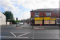
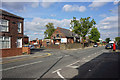
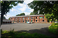
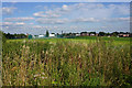
35 photos from this area
Area Information
Key information about the BL4 0RR including its size, population, and administrative classification.
- Area Type
- Postcode
- Area Size
- 5.0 hectares
- Population
- 1967
- Population Density
- 5004 people/km²
House Prices in BL4 0RR
91
Properties
£98,056
Average Sold Price
£19,000
Lowest Price
£190,000
Highest Price
Showing 91 properties
| Address | Type | Beds | Baths | Last Sale Price | Last Sale Date | |
|---|---|---|---|---|---|---|
| 41 Highfield Drive, Farnworth, Bolton, BL4 0RR | Semi-detached | 2 | 1 | £185,000 | Feb 2025 | |
| 71 Highfield Drive, Farnworth, Bolton, BL4 0RR | Semi-detached | 3 | 1 | £130,000 | Dec 2023 | |
| 39 Highfield Drive, Farnworth, Bolton, BL4 0RR | Semi-detached | 2 | 1 | £180,000 | Oct 2023 | |
| 141 Highfield Drive, Farnworth, Bolton, BL4 0RR | Semi-detached | 2 | 1 | £140,000 | May 2023 | |
| 153 Highfield Drive, Farnworth, Bolton, BL4 0RR | Semi-detached | 2 | 1 | £139,000 | Feb 2023 | |
| 75 Highfield Drive, Farnworth, Bolton, BL4 0RR | Retail | 3 | - | £190,000 | Mar 2022 | |
| 17 Highfield Drive, Farnworth, Bolton, BL4 0RR | Retail | 3 | 1 | £173,000 | Mar 2022 | |
| 21 Highfield Drive, Farnworth, Bolton, BL4 0RR | house | - | - | £165,000 | Nov 2021 | |
| 61 Highfield Drive, Farnworth, Bolton, BL4 0RR | Detached | 2 | 1 | £130,000 | Nov 2021 | |
| 149 Highfield Drive, Farnworth, Bolton, BL4 0RR | house | - | - | £130,000 | Nov 2021 |
Page 1 of 10
Energy Efficiency in BL4 0RR
Amenities
Schools
| Rank | School | Type | Entry gender | Ages |
|---|
Explore more schools in this area
Go to Schools tabDemographics
Household Size
Family (3-5 people)
most common
Accommodation Type
Houses
most common
Tenure
46
majority
Ethnic Group
White
most common
Religion
N/A
most common
Household Composition
N/A
most common
Age
47
median
Adults (30-64 years)
most common
Household Deprivation
N/A
with no deprivation
NS-SEC
17
in Lower managerial occupations
Explore more demographic insights in this area
Go to Demographics tabPlanning
Planning Constraints
- Flood RiskPremium
- Ramsar Wetland SitesPremium
- Area of Outstanding Natural BeautyPremium
- Protected Nature ReservePremium
- Protected WoodlandPremium