Area Overview for BL4 0QR
Photos of BL4 0QR
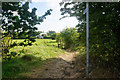
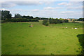
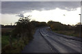
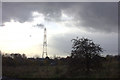
23 photos from this area
Area Information
Key information about the BL4 0QR including its size, population, and administrative classification.
- Area Type
- Postcode
- Area Size
- 9821 m²
- Population
- 1967
- Population Density
- 5004 people/km²
House Prices in BL4 0QR
38
Properties
£81,538
Average Sold Price
£25,000
Lowest Price
£138,500
Highest Price
Showing 38 properties
| Address | Type | Beds | Baths | Last Sale Price | Last Sale Date | |
|---|---|---|---|---|---|---|
| 4 Tern Avenue, Farnworth, Bolton, BL4 0QR | house | 3 | - | £138,500 | Aug 2025 | |
| 34 Tern Avenue, Farnworth, Bolton, BL4 0QR | Terraced | 3 | 1 | £92,500 | Jan 2020 | |
| 8 Tern Avenue, Farnworth, Bolton, BL4 0QR | Semi-detached | 3 | 1 | £105,000 | Jul 2019 | |
| 23 Tern Avenue, Farnworth, Bolton, BL4 0QR | house | 3 | 1 | £105,000 | Nov 2018 | |
| 2 Tern Avenue, Farnworth, Bolton, BL4 0QR | Semi-detached | 3 | 1 | £82,000 | Nov 2015 | |
| 24 Tern Avenue, Farnworth, Bolton, BL4 0QR | Terraced | 3 | 1 | £98,000 | Oct 2015 | |
| 35 Tern Avenue, Farnworth, Bolton, BL4 0QR | Terraced | 1 | 1 | £65,000 | Mar 2015 | |
| 36 Tern Avenue, Farnworth, Bolton, BL4 0QR | house | 3 | - | £90,000 | Oct 2007 | |
| 21 Tern Avenue, Farnworth, Bolton, BL4 0QR | Semi-detached | - | - | £86,000 | Oct 2007 | |
| 14 Tern Avenue, Farnworth, Bolton, BL4 0QR | house | - | - | £81,000 | Sep 2007 |
Page 1 of 4
Energy Efficiency in BL4 0QR
Amenities
Schools
| Rank | School | Type | Entry gender | Ages |
|---|
Explore more schools in this area
Go to Schools tabDemographics
Household Size
Family (3-5 people)
most common
Accommodation Type
Houses
most common
Tenure
46
majority
Ethnic Group
White
most common
Religion
N/A
most common
Household Composition
N/A
most common
Age
47
median
Adults (30-64 years)
most common
Household Deprivation
N/A
with no deprivation
NS-SEC
17
in Lower managerial occupations
Explore more demographic insights in this area
Go to Demographics tabPlanning
Planning Constraints
- Flood RiskPremium
- Ramsar Wetland SitesPremium
- Area of Outstanding Natural BeautyPremium
- Protected Nature ReservePremium
- Protected WoodlandPremium