Area Overview for BL4 0JY
Photos of BL4 0JY

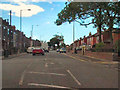
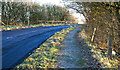
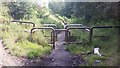
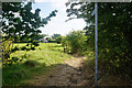


23 photos from this area
Area Information
Key information about the BL4 0JY including its size, population, and administrative classification.
- Area Type
- Postcode
- Area Size
- 1.4 hectares
- Population
- 1669
- Population Density
- 3159 people/km²
House Prices in BL4 0JY
22
Properties
£162,446
Average Sold Price
£59,500
Lowest Price
£290,000
Highest Price
Showing 22 properties
| Address | Type | Beds | Baths | Last Sale Price | Last Sale Date | |
|---|---|---|---|---|---|---|
| 488 Plodder Lane, Farnworth, Bolton, BL4 0JY | Semi-detached | 3 | 1 | £244,500 | Aug 2024 | |
| 470 Plodder Lane, Farnworth, Bolton, BL4 0JY | Semi-detached | 4 | 1 | £290,000 | Jul 2023 | |
| 480 Plodder Lane, Farnworth, Bolton, BL4 0JY | Semi-detached | 3 | 1 | £185,000 | Jan 2023 | |
| 500 Plodder Lane, Farnworth, Bolton, BL4 0JY | Semi-detached | 3 | 1 | £225,000 | Oct 2020 | |
| 468 Plodder Lane, Farnworth, Bolton, BL4 0JY | Semi-detached | 2 | 1 | £145,000 | Aug 2020 | |
| 482 Plodder Lane, Farnworth, Bolton, BL4 0JY | Semi-detached | 4 | 1 | £185,000 | Feb 2019 | |
| 502 Plodder Lane, Farnworth, Bolton, BL4 0JY | Semi-detached | 3 | 1 | £112,500 | Aug 2014 | |
| 498 Plodder Lane, Farnworth, Bolton, BL4 0JY | Semi-detached | 3 | 1 | £138,000 | Nov 2013 | |
| 494 Plodder Lane, Farnworth, Bolton, BL4 0JY | house | - | - | £136,750 | Aug 2013 | |
| 472A Plodder Lane, Farnworth, Bolton, BL4 0JY | house | - | - | £90,000 | Oct 2012 |
Page 1 of 3
Energy Efficiency in BL4 0JY
Amenities
Schools
| Rank | School | Type | Entry gender | Ages |
|---|
Explore more schools in this area
Go to Schools tabDemographics
Household Size
Family (3-5 people)
most common
Accommodation Type
Houses
most common
Tenure
72
majority
Ethnic Group
White
most common
Religion
N/A
most common
Household Composition
N/A
most common
Age
47
median
Adults (30-64 years)
most common
Household Deprivation
N/A
with no deprivation
NS-SEC
26
in Lower managerial occupations
Explore more demographic insights in this area
Go to Demographics tabPlanning
Planning Constraints
- Flood RiskPremium
- Ramsar Wetland SitesPremium
- Area of Outstanding Natural BeautyPremium
- Protected Nature ReservePremium
- Protected WoodlandPremium