Area Overview for BL3 4SA
Photos of BL3 4SA
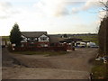
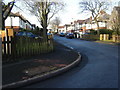
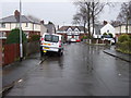
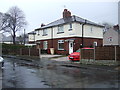
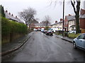
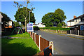
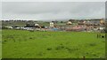
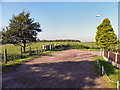
16 photos from this area
Area Information
Key information about the BL3 4SA including its size, population, and administrative classification.
- Area Type
- Postcode
- Area Size
- 11.3 hectares
- Population
- 1596
- Population Density
- 1067 people/km²
House Prices in BL3 4SA
59
Properties
£102,050
Average Sold Price
£25,000
Lowest Price
£170,000
Highest Price
Showing 59 properties
| Address | Type | Beds | Baths | Last Sale Price | Last Sale Date | |
|---|---|---|---|---|---|---|
| 12 Doyle Road, Bolton, BL3 4SA | Terraced | 3 | 1 | £170,000 | Aug 2024 | |
| 22 Doyle Road, Bolton, BL3 4SA | house | - | - | £65,000 | Dec 2022 | |
| 61 Doyle Road, Bolton, BL3 4SA | house | 3 | - | £106,250 | Oct 2020 | |
| 39 Doyle Road, Bolton, BL3 4SA | Semi-detached | 4 | 2 | £157,000 | May 2020 | |
| 5 Doyle Road, Bolton, BL3 4SA | house | - | - | £136,000 | Nov 2019 | |
| 4 Doyle Road, Bolton, BL3 4SA | Semi-detached | 3 | 1 | £134,950 | Apr 2019 | |
| 57 Doyle Road, Bolton, BL3 4SA | Semi-detached | 3 | 1 | £105,000 | Mar 2019 | |
| 49 Doyle Road, Bolton, BL3 4SA | Terraced | 3 | 1 | £95,000 | Jul 2018 | |
| 69 Doyle Road, Bolton, BL3 4SA | Retail | 3 | 1 | £87,000 | Sep 2017 | |
| 15 Doyle Road, Bolton, BL3 4SA | house | 3 | 1 | £80,000 | Aug 2016 |
Page 1 of 6
Energy Efficiency in BL3 4SA
Amenities
Schools
| Rank | School | Type | Entry gender | Ages |
|---|
Explore more schools in this area
Go to Schools tabDemographics
Household Size
Family (3-5 people)
most common
Accommodation Type
Houses
most common
Tenure
75
majority
Ethnic Group
White
most common
Religion
N/A
most common
Household Composition
N/A
most common
Age
47
median
Adults (30-64 years)
most common
Household Deprivation
N/A
with no deprivation
NS-SEC
31
in Lower managerial occupations
Explore more demographic insights in this area
Go to Demographics tabPlanning
Planning Constraints
- Flood RiskPremium
- Ramsar Wetland SitesPremium
- Area of Outstanding Natural BeautyPremium
- Protected Nature ReservePremium
- Protected WoodlandPremium