Area Overview for BL3 4NX
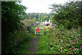
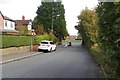
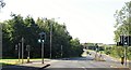
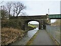
Photos of BL3 4NX


Area Information
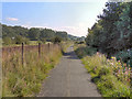
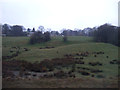
Living in BL3 4NX means residing within a specific residential cluster centred on the historic Lostock, Heaton, and Chew Moor wards of Greater Manchester. This postcode covers 8,166 square metres, creating a tightly knit environment where community interaction is a natural part of daily life. The location sits approximately 3.5 miles west of Bolton town centre and 13 miles northwest of Manchester city centre. Historically part of Lancashire, this area has evolved from a mix of agricultural land and manor estates into a predominantly suburban residential zone. The ward includes named landmarks such as the Grade II* listed Lostock Hall gatehouse and the Church of St Mary, which anchor the local landscape. Residents benefit from proximity to Middlebrook and connections to the wider Heaton and Lostock community. This small cluster offers a distinct identity separate from the larger urban sprawls while maintaining access to metropolitan services. The area represents a practical choice for those seeking a defined residential address with deep historical roots in the North West.
- Area Type
- Postcode
- Area Size
- 8166 m²
- Population
- 1744
- Population Density
- 2905 people/km²
The property market in BL3 4NX is characterised by a strong dominance of owner-occupiers. With 83% home ownership, this postcode represents a settled market rather than a volatile letting scheme. Houses constitute the primary accommodation type, meaning buyers looking at homes in this area will primarily encounter detached or semi-detached structures rather than purpose-built flats or terraces. The 1744 population residing in this 8,166 square metre cluster indicates a low-rise, density-controlled environment suitable for those preferring traditional housing stock. This high ownership rate typically correlates with stable neighbourhoods where investment returns are realised through property appreciation rather than rental yield. Families looking for homes in BL3 4NX can expect to find residences that suit larger households, given the prevalence of house types over apartments. The market dynamics reflect a community where residents have invested in their local infrastructure and feel a strong sense of permanence in their addresses.
House Prices in BL3 4NX
Showing 11 properties
| Address | Type | Beds | Baths | Last Sale Price | Last Sale Date | |
|---|---|---|---|---|---|---|
| 8 Farland Place, Bolton, BL3 4NX | Semi-detached | 3 | 1 | £272,000 | Jul 2023 | |
| 12 Farland Place, Bolton, BL3 4NX | Semi-detached | 4 | - | £200,000 | Nov 2020 | |
| 9 Farland Place, Bolton, BL3 4NX | Semi-detached | 3 | 1 | £227,000 | Apr 2020 | |
| 3 Farland Place, Bolton, BL3 4NX | Semi-detached | - | - | £157,000 | Jun 2004 | |
| 5 Farland Place, Bolton, BL3 4NX | Semi-detached | - | - | £148,000 | Jul 2003 | |
| 6 Farland Place, Bolton, BL3 4NX | Semi-detached | 3 | 2 | - | - | |
| 2 Farland Place, Bolton, BL3 4NX | Semi-detached | - | - | - | - | |
| 10 Farland Place, Bolton, BL3 4NX | Semi-detached | - | - | - | - | |
| 4 Farland Place, Bolton, BL3 4NX | Semi-detached | - | - | - | - | |
| 1 Farland Place, Bolton, BL3 4NX | Detached | - | - | - | - |
Energy Efficiency in BL3 4NX
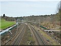
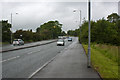
Residents of BL3 4NX enjoy convenient access to a variety of retail and transport hubs within practical reach. Five retail options are available nearby, including Heron Wigan, Co-op Wigan, and Tesco Bolton Wigan. These establishments cover essential shopping needs without requiring a long drive into the city centre. Public transport accessibility is strong, with five railway stations serving the immediate surroundings. Lostock Railway Station, Bolton Railway Station, and Westhoughton Railway Station are the notable stops, connecting residents to wider networks. The availability of these transport links facilitates easy commutes to Bolton and Manchester. Daily life involves balancing local convenience with regional connectivity, ensuring that lifestyle choices remain flexible. The combination of supermarkets and rail access creates a self-sufficient environment for most household requirements.
Amenities
Schools
Families residing in BL3 4NX have access to a range of educational institutions with verified Ofsted ratings. Ladybridge Community Primary School holds a Good rating and sits within the immediate vicinity. Residents can also utilise St Mary's CofE Primary School in Deane, which carries an Outstanding rating and offers high-quality early education. For older children, Ladybridge High School is listed as a nearby option with a Good rating. A special education option exists via Rumworth School, which caters to specific learning needs within the region. This mix of primary and special provision schools supports diverse educational requirements. The presence of multiple rated institutions ensures that parents have choices when seeking schools near BL3 4NX. The specific Ofsted classifications provide assurance regarding the standard of teaching and care offered at each facility.
| Rank | School | Type | Entry gender | Ages |
|---|
Explore more schools in this area
Go to Schools tabDemographics
The community in BL3 4NX demonstrates clear patterns regarding age and household composition. The median age of residents is 47 years, indicating that adults between 30 and 64 years represent the most common age range. This demographic profile suggests a population with established careers and likely borne children. Home ownership is exceptionally high at 83%, signifying that the vast majority of residents own their properties outright or with significant equity. Houses form the predominant accommodation type, reinforcing the character of this neighbourhood as a family-oriented residential estate. The predominant ethnic group is White, which aligns with the broader ward character notes of 69% White backgrounds. Single-person households make up 26% of the social fabric, while families with dependent children account for 29%. These figures describe a stabilising community where long-term residents form the backbone of the local population.
Household Size
Accommodation Type
Tenure
Ethnic Group
Religion
Household Composition
Age
Household Deprivation
NS-SEC
Explore more demographic insights in this area
Go to Demographics tabPlanning
Planning Constraints
- Flood RiskPremium
- Ramsar Wetland SitesPremium
- Area of Outstanding Natural BeautyPremium
- Protected Nature ReservePremium
- Protected WoodlandPremium