Area Overview for BL3 4HT
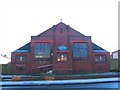
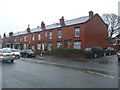
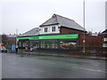
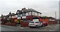
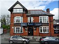
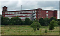
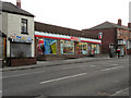
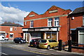
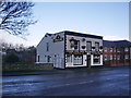
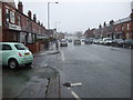
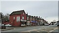
Photos of BL3 4HT

Area Information
BL3 4HT is a small residential cluster in the heart of Rumworth, a ward within Bolton, Greater Manchester. With a population of 1,745, it is a tight-knit community nestled in an area historically shaped by coal mining and textile industries. The postcode falls within the former parish of Deane, which once spanned much of modern-day Bolton. Today, the area is characterised by a mature demographic, with a median age of 47 and a majority of residents aged 30–64. The presence of St Mary’s Church, a focal point of the medieval parish, adds a layer of historical continuity to the area. While the population is relatively small, the proximity to major transport links like Bolton and Lostock railway stations makes it accessible to nearby urban centres. The mix of residential housing and community amenities suggests a balance between suburban tranquillity and connectivity to regional services. For those seeking a compact, well-served area with a distinct local identity, BL3 4HT offers a blend of historical roots and modern practicality.
- Area Type
- Postcode
- Area Size
- Not available
- Population
- 1745
- Population Density
- 13300 people/km²
BL3 4HT is primarily a housing area dominated by individual homes, with 56% of properties owned by residents. This suggests a mix of owner-occupied and rental properties, though the exact proportion of rentals is not specified. The prevalence of houses over flats or apartments indicates a suburban or semi-rural character, potentially appealing to families seeking space and privacy. Given the small population of 1,745, the housing stock is limited, which could make the market competitive for buyers. The area’s proximity to transport hubs like Bolton and Lostock railway stations may attract commuters, but the small size of the postcode means properties are likely tightly clustered. For buyers, this presents both opportunities and challenges: the area offers a distinct local identity but may lack the diversity of housing options found in larger urban centres. Those considering BL3 4HT should weigh the advantages of a close-knit community against the potential limitations of a constrained property market.
House Prices in BL3 4HT
No properties found in this postcode.
Energy Efficiency in BL3 4HT
BL3 4HT offers a range of nearby amenities that support daily life. Retail options include Heron Wigan, Tesco Bolton Wigan, and Co-op Wigan, providing access to groceries, clothing, and other essentials. The proximity to Bolton and Lostock railway stations connects residents to broader retail and leisure opportunities in the surrounding area. While the data does not specify parks or recreational facilities, the area’s historical roots in industrial activity suggest a potential focus on community spaces. The presence of multiple schools and transport links indicates a community-oriented lifestyle, with services tailored to families and commuters. The small size of the postcode means amenities are likely within walking or short driving distance, contributing to a convenient, compact living experience. For residents, the combination of retail access and transport connectivity ensures that daily needs are met without the need for long commutes.
Amenities
Schools
Residents of BL3 4HT have access to three primary schools within practical reach. St Ethelbert’s RC Primary School is a state-funded institution, while Al Jamiah Al Islamiyyah is an independent school with an Ofsted rating of satisfactory. A second St Ethelbert’s Roman Catholic Primary School, also a primary school, serves the area. The presence of both state and independent options provides families with choices, though the independent school’s rating suggests room for improvement in certain areas. The concentration of primary schools indicates a focus on education, which is likely a key factor for families considering the area. The mix of school types may cater to different educational preferences, from faith-based institutions to secular alternatives. However, the lack of secondary schools in the immediate vicinity could necessitate travel for older students, a consideration for parents planning long-term residency.
| Rank | School | Type | Entry gender | Ages |
|---|
Explore more schools in this area
Go to Schools tabDemographics
The population of BL3 4HT is predominantly adults aged 30–64, with a median age of 47. This suggests a community of established professionals and families, likely with children in local schools. Home ownership rates stand at 56%, indicating a mix of owner-occupied properties and rental homes. The area is composed mainly of houses, reflecting a residential character that contrasts with high-density housing. The predominant ethnic group is Asian_total, which shapes the cultural fabric of the neighbourhood. While no specific deprivation data is provided, the demographic profile implies a stable, middle-aged population with established ties to the area. The absence of younger families or students may influence local services and amenities, though the presence of multiple primary schools suggests a focus on education. The age profile and home ownership figures together indicate a community that values stability and long-term residency, with a strong emphasis on family-oriented living.
Household Size
Accommodation Type
Tenure
Ethnic Group
Religion
Household Composition
Age
Household Deprivation
NS-SEC
Explore more demographic insights in this area
Go to Demographics tabPlanning
Planning Constraints
- Flood RiskPremium
- Ramsar Wetland SitesPremium
- Area of Outstanding Natural BeautyPremium
- Protected Nature ReservePremium
- Protected WoodlandPremium