Area Overview for BL3 3QH
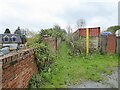
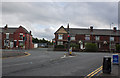
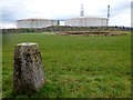
Photos of BL3 3QH

Area Information
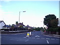
BL3 3QH lies within Hulton Ward, a small residential cluster in Bolton Metropolitan Borough Council, approximately 5km south-west of Bolton town centre. This area forms part of the suburb of Westhoughton, historically rooted in Over Hulton, Middle Hulton, and Little Hulton townships. With a population of 1,530 and a density of 278 people per square kilometre, it is a compact community where the past and present coexist. The area’s character is shaped by its history as part of the Hulton family estate, whose influence extended to local railways and events like the Peterloo Massacre. Today, BL3 3QH is a quiet residential enclave, with homes predominantly in the 30-64 age range. Its proximity to Bolton and nearby towns offers a balance of suburban tranquillity and urban accessibility, making it a practical choice for those seeking a stable, low-density living environment.
- Area Type
- Postcode
- Area Size
- Not available
- Population
- 1530
- Population Density
- 278 people/km²
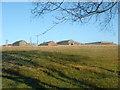
BL3 3QH is a predominantly owner-occupied area, with 82% of homes in private hands. The accommodation type is exclusively houses, not flats, which is typical of suburban and semi-rural settings. This suggests a housing stock characterised by detached or semi-detached properties, likely offering more space than urban areas. Given the small population and low density, the market is limited in scale, with limited scope for new developments. Buyers should consider the proximity to Bolton and nearby transport links, which enhance the area’s appeal as a commuter suburb. The focus on owner-occupied homes indicates a stable market, though the small size of the area may mean limited options for buyers seeking a wider range of properties.
House Prices in BL3 3QH
No properties found in this postcode.
Energy Efficiency in BL3 3QH
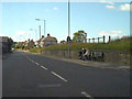
BL3 3QH offers practical amenities within reach, including five retail outlets such as Morrisons Daily Bolton, Asda Daubhill, and Co-op Wigan. These shops provide essential services for daily living, from groceries to household supplies. The area’s proximity to rail stations and the Radcliffe metro station enhances mobility, allowing residents to access wider leisure, shopping, and employment opportunities in Bolton and beyond. While the data does not specify parks or leisure facilities, the lack of planning constraints suggests open spaces may be available nearby. The combination of retail access and transport links creates a convenient lifestyle, balancing local convenience with regional connectivity.
Amenities
Schools
The nearest school to BL3 3QH is Heathfield Primary School, which has an Ofsted rating of ‘good’. This indicates a reliable educational option for young families in the area. As a primary school, it serves children aged 4-11, covering the early stages of education. The absence of secondary schools in the immediate vicinity means families may need to consider nearby towns for secondary education, but the ‘good’ rating suggests a strong foundation for early learning. For parents prioritising quality education, Heathfield Primary’s presence is a notable advantage, though further research would be needed to assess secondary options in the broader region.
| Rank | School | Type | Entry gender | Ages |
|---|
Explore more schools in this area
Go to Schools tabDemographics
The population of BL3 3QH is 1,530, with a median age of 47, reflecting a community skewed towards adults aged 30-64. Home ownership is high at 82%, indicating a stable, long-term resident base. The area is predominantly occupied by houses, not flats, which aligns with the demographic profile of established families. The predominant ethnic group is White, though no specific data on diversity or deprivation is provided. This suggests a homogenous community with a focus on traditional homeownership. The age range and ownership figures imply a mature, settled population, likely with strong local ties and a focus on family-oriented living.
Household Size
Accommodation Type
Tenure
Ethnic Group
Religion
Household Composition
Age
Household Deprivation
NS-SEC
Explore more demographic insights in this area
Go to Demographics tabPlanning
Planning Constraints
- Flood RiskPremium
- Ramsar Wetland SitesPremium
- Area of Outstanding Natural BeautyPremium
- Protected Nature ReservePremium
- Protected WoodlandPremium