Area Overview for BL3 2RJ
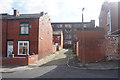
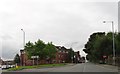
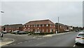
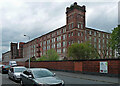
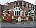
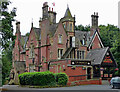
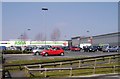
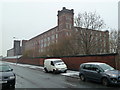
Photos of BL3 2RJ


Area Information
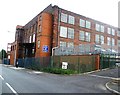
BL3 2RJ is a compact residential cluster in Bolton, Greater Manchester, covering just 1.5 hectares and home to 2,402 people. Its high population density of 160,943 people per square kilometre reflects a tightly packed community, typical of urban or semi-urban settings. Situated near Bolton railway station, the area is part of Great Lever, a historic township with roots in 19th-century industrial activity. Today, it blends residential living with proximity to transport links and retail hubs. The area’s small size means residents are likely to find amenities within walking distance, though the density may contribute to a sense of closeness among neighbours. With a median age of 22 and a majority of adults aged 30–64, the community is a mix of younger residents and working-age families. This demographic suggests a dynamic, possibly transient population, with a focus on employment in nearby industrial or commercial zones. Living here offers convenience but also demands consideration of space constraints and community dynamics.
- Area Type
- Postcode
- Area Size
- 1.5 hectares
- Population
- Not available
- Population Density
- Not available
BL3 2RJ is a small area with limited housing stock, dominated by houses rather than flats or apartments. With only 42% of homes owner-occupied, the market appears to lean heavily toward rental properties, suggesting a transient or younger demographic. The compact size of the area means buyers must consider nearby neighbourhoods for more extensive housing options. The high population density of 160,943 people per square kilometre indicates a scarcity of space, which may drive up property values or limit availability. For those seeking owner-occupied homes, the focus on houses could appeal to families requiring more living space. However, the small footprint of BL3 2RJ means buyers should explore adjacent areas for a broader selection. The market’s reliance on rentals may also reflect the area’s role as a commuter hub, with proximity to rail and metro links.
House Prices in BL3 2RJ
No properties found in this postcode.
Energy Efficiency in BL3 2RJ
Residents of BL3 2RJ have access to a range of amenities within practical reach, including retail outlets like Aldi Vincent, Spar Manchester, and Asda Burnden, which cater to daily shopping needs. The area’s proximity to multiple railway stations and metro stops ensures easy travel to workplaces, schools, and leisure destinations. While parks or recreational spaces are not explicitly listed in the data, the historical industrial context of Great Lever suggests potential for green spaces near former industrial sites. The presence of retail and transport hubs indicates a functional, convenience-driven lifestyle, though the compact size of the area may limit options for larger leisure facilities. Overall, the mix of retail, transport, and nearby services supports a practical, accessible daily life for residents.
Amenities
Schools
The nearest school to BL3 2RJ is St Michael’s CofE Primary School in Great Lever, which holds an Ofsted rating of ‘good’. This primary school serves the local community, offering education for younger children. However, the data does not list secondary schools or other educational institutions nearby, meaning families may need to look further afield for comprehensive schooling. The presence of a primary school with a positive rating is a benefit for parents prioritising early education, but the lack of detailed information on secondary options could be a concern. The school’s location within walking distance of BL3 2RJ makes it accessible for families, though the absence of additional educational facilities may require careful planning for older children.
| Rank | School | Type | Entry gender | Ages |
|---|
Explore more schools in this area
Go to Schools tabDemographics
BL3 2RJ has a median age of 22, though the most common age range among residents is 30–64 years, indicating a population skewed toward working-age adults. Only 42% of homes are owner-occupied, suggesting a significant proportion of renters, which may influence the local housing market’s stability. The area is predominantly composed of houses, not flats or apartments, which is unusual for such a densely populated postcode. The predominant ethnic group is Asian, reflecting broader demographic trends in Bolton. This diversity shapes the area’s cultural landscape but does not directly impact the data on deprivation, which is not provided. The high proportion of adults aged 30–64 implies a community focused on employment and family life, with potential demand for schools and local services. The low home ownership rate may indicate a reliance on rental markets, which could affect long-term investment prospects.
Household Size
Accommodation Type
Tenure
Ethnic Group
Religion
Household Composition
Age
Household Deprivation
NS-SEC
Explore more demographic insights in this area
Go to Demographics tabPlanning
Planning Constraints
- Flood RiskPremium
- Ramsar Wetland SitesPremium
- Area of Outstanding Natural BeautyPremium
- Protected Nature ReservePremium
- Protected WoodlandPremium