Area Overview for BL3 2RH
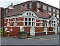
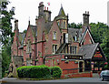
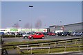
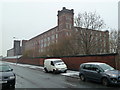
Photos of BL3 2RH


Area Information
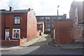
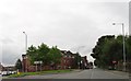
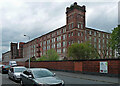
BL3 2RH is a small residential postcode area in Bolton, Greater Manchester, with a population of 2,402. It lies within the historical township of Great Lever, once a village described in the 1870s as part of Middleton parish, Lancashire. The area is defined by its compact size and proximity to Bolton’s railway network. Daily life here is shaped by its industrial heritage, with remnants of 19th-century chemical works and collieries now replaced by modest housing. The community is young, with a median age of 22, and predominantly occupied by adults aged 30–64. Living here means navigating a mix of practical amenities and historical context, with easy access to rail links and local shops. The area’s small scale means residents are likely to know their neighbours, though the high crime risk—above average—requires awareness of personal security. For buyers, BL3 2RH offers a snapshot of a working-class suburb with limited modern development, where the past and present coexist in a tightly packed residential cluster.
- Area Type
- Postcode
- Area Size
- Not available
- Population
- Not available
- Population Density
- Not available
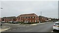
The property market in BL3 2RH is characterised by a 42% home ownership rate, with houses being the primary accommodation type. This suggests a modest housing stock, likely consisting of older, smaller properties typical of post-industrial suburbs. The low home ownership percentage indicates a rental market that may dominate, particularly for younger residents or those seeking temporary housing. Given the area’s small size, property availability is limited, and buyers should consider the proximity to Bolton’s rail network as a key selling point. The predominance of houses over flats or apartments may appeal to families but could limit options for those seeking modern or larger units. For investors, the market’s stability hinges on local infrastructure and the continued relevance of nearby transport links, which are critical for connectivity to Manchester and surrounding areas.
House Prices in BL3 2RH
No properties found in this postcode.
Energy Efficiency in BL3 2RH
Residents of BL3 2RH have access to a range of local amenities, including five retail outlets such as Aldi Vincent, Spar Manchester, and Asda Burnden. These shops provide essentials, though the selection may be limited compared to larger towns. The area’s proximity to rail and metro stations enhances mobility, allowing residents to reach broader retail, dining, and leisure options in Bolton or Manchester. While specific parks or recreational spaces are not listed in the data, the historical industrial landscape suggests potential for community spaces or green areas nearby. The lifestyle here is practical and community-focused, with daily life revolving around local shops, public transport, and the broader Greater Manchester network. The small scale of the area means amenities are concentrated, requiring residents to plan trips for more specialised services.
Amenities
Schools
The nearest school to BL3 2RH is St Michael’s CofE Primary School in Great Lever, which provides primary education and holds a ‘good’ Ofsted rating. This school serves the local community, offering a foundation for children’s early education. The absence of secondary schools in the immediate area means families may need to travel to nearby towns for secondary education, such as Bolton or Bury. The presence of a primary school with a positive rating is a practical advantage for families, though the lack of higher-tier educational institutions nearby could influence decisions about long-term residency. Parents should consider the broader school network in Bolton when planning for their children’s schooling.
| Rank | School | Type | Entry gender | Ages |
|---|
Explore more schools in this area
Go to Schools tabDemographics
The population of BL3 2RH is 2,402, with a median age of 22, reflecting a community skewed toward younger adults. The most common age group is 30–64 years, indicating a mix of working-age residents and families. Home ownership here is relatively low at 42%, suggesting a higher proportion of renters compared to owner-occupied homes. The predominant accommodation type is houses, though the small area size implies limited housing diversity. The predominant ethnic group is Asian, which influences the cultural character of the neighbourhood. Deprivation data, while not explicitly provided, can be inferred from the low home ownership and the area’s historical industrial legacy—factors that may affect access to services or economic opportunities. For residents, this means a community with strong familial ties but potential challenges in housing stability and resource availability.
Household Size
Accommodation Type
Tenure
Ethnic Group
Religion
Household Composition
Age
Household Deprivation
NS-SEC
Explore more demographic insights in this area
Go to Demographics tabPlanning
Planning Constraints
- Flood RiskPremium
- Ramsar Wetland SitesPremium
- Area of Outstanding Natural BeautyPremium
- Protected Nature ReservePremium
- Protected WoodlandPremium