Area Overview for BL2 6QJ
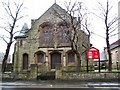
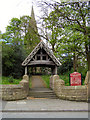
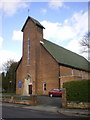
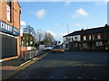
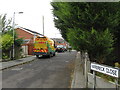
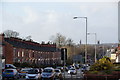
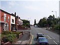
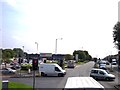
Photos of BL2 6QJ
Area Information
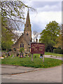
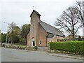
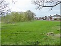
BL2 6QJ lies within the historic township of Breightmet, a small residential cluster in Bolton, Greater Manchester. With a population of 1,613, the area reflects a blend of historical significance and modern living. Once a hub for textile manufacturing, Breightmet evolved from rural farmland into a settled community, retaining traces of its past in landmarks like Roscoe Fold School, built on the site of a 14th-century manor. The area’s compact size means residents are close to key amenities, including five railway stations and nearby retail outlets such as Iceland Bolton and Aldi Breightmet. Daily life here is shaped by its proximity to Bolton’s town centre, with easy access to rail links to Bury and Manchester. The median age of 47 suggests a stable, established community, with many residents in their prime working years. While the area lacks large-scale commercial hubs, its charm lies in its quiet residential character and historical roots, offering a contrast to the busier parts of Greater Manchester.
- Area Type
- Postcode
- Area Size
- Not available
- Population
- 1613
- Population Density
- 2990 people/km²
BL2 6QJ is primarily an owner-occupied area, with 59% of residents living in homes they own. The accommodation type is predominantly houses, reflecting a traditional, low-density housing stock typical of older residential areas. This contrasts with newer developments that often feature flats or apartments. The small size of the postcode means the property market is limited to a handful of homes, making it a niche area for buyers. Those seeking a family home may find the availability of houses appealing, though the lack of large-scale housing developments could mean limited options. Proximity to rail links and local amenities adds value, but buyers should consider the area’s compact nature and the need to commute beyond Breightmet for more extensive services.
House Prices in BL2 6QJ
No properties found in this postcode.
Energy Efficiency in BL2 6QJ
Living in BL2 6QJ offers access to a range of local amenities, from essential retail to transport hubs. The area’s five railway stations, including Bolton and Moses Gate, ensure frequent connections to Manchester and Bury, while nearby metro stops provide additional flexibility. Retail options include Iceland Bolton, Aldi Breightmet, and Spar, catering to everyday needs. The historical character of the area is evident in landmarks like Roscoe Fold School, built on the site of a 14th-century manor, and Bradshaw Brook Banks, where remnants of old farmsteads remain. Though small, the area’s proximity to Bolton’s town centre means residents can access larger shopping and dining options nearby. The mix of practical amenities and historical features creates a lived-in, community-focused lifestyle.
Amenities
Schools
| Rank | School | Type | Entry gender | Ages |
|---|
Explore more schools in this area
Go to Schools tabDemographics
The population of BL2 6QJ is 1,613, with a median age of 47. Over half the residents—59%—own their homes, a figure that aligns with the area’s predominantly owner-occupied housing stock, which consists mainly of houses rather than flats. The most common age range is adults aged 30–64, indicating a mature, settled community. The predominant ethnic group is White, reflecting the area’s historical ties to local industries and limited recent demographic shifts. This age profile suggests a population focused on stability, with many likely employed in nearby sectors or commuting to Bolton and Manchester. The absence of specific data on deprivation means the quality of life here is inferred from the availability of amenities and low environmental risks, though the high crime risk score of 0/100 warrants caution.
Household Size
Accommodation Type
Tenure
Ethnic Group
Religion
Household Composition
Age
Household Deprivation
NS-SEC
Explore more demographic insights in this area
Go to Demographics tabPlanning
Planning Constraints
- Flood RiskPremium
- Ramsar Wetland SitesPremium
- Area of Outstanding Natural BeautyPremium
- Protected Nature ReservePremium
- Protected WoodlandPremium