Area Overview for BL2 6EL
Photos of BL2 6EL
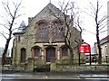
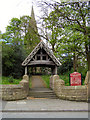
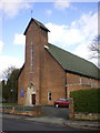
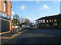
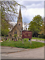
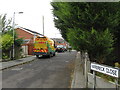
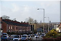
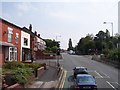
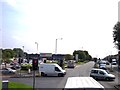
26 photos from this area
Area Information
Key information about the BL2 6EL including its size, population, and administrative classification.
- Area Type
- Postcode
- Area Size
- 1.1 hectares
- Population
- 1674
- Population Density
- 3194 people/km²
House Prices in BL2 6EL
27
Properties
£100,578
Average Sold Price
£12,000
Lowest Price
£205,000
Highest Price
Showing 27 properties
| Address | Type | Beds | Baths | Last Sale Price | Last Sale Date | |
|---|---|---|---|---|---|---|
| 85 Blenheim Road, Bolton, BL2 6EL | Semi-detached | 3 | 1 | £205,000 | Oct 2025 | |
| 87 Blenheim Road, Bolton, BL2 6EL | house | - | - | £132,000 | Jun 2021 | |
| 97 Blenheim Road, Bolton, BL2 6EL | Semi-detached | 3 | 1 | £140,000 | Mar 2021 | |
| 95 Blenheim Road, Bolton, BL2 6EL | Semi-detached | 3 | 1 | £140,000 | Apr 2019 | |
| 83 Blenheim Road, Bolton, BL2 6EL | Semi-detached | 3 | 1 | £116,500 | Aug 2016 | |
| 93 Blenheim Road, Bolton, BL2 6EL | house | - | - | £52,250 | Apr 2003 | |
| 81 Blenheim Road, Bolton, BL2 6EL | Semi-detached | - | - | £52,000 | Jul 2001 | |
| 89 Blenheim Road, Bolton, BL2 6EL | Semi-detached | - | - | £55,450 | Apr 2001 | |
| 121 Blenheim Road, Bolton, BL2 6EL | house | - | - | £12,000 | Sep 1996 | |
| 107 Blenheim Road, Bolton, BL2 6EL | house | - | - | - | - |
Page 1 of 3
Energy Efficiency in BL2 6EL
Amenities
Schools
| Rank | School | Type | Entry gender | Ages |
|---|
Explore more schools in this area
Go to Schools tabDemographics
Household Size
Family (3-5 people)
most common
Accommodation Type
Houses
most common
Tenure
28
majority
Ethnic Group
White
most common
Religion
N/A
most common
Household Composition
N/A
most common
Age
47
median
Adults (30-64 years)
most common
Household Deprivation
N/A
with no deprivation
NS-SEC
15
in Lower managerial occupations
Explore more demographic insights in this area
Go to Demographics tabPlanning
Planning Constraints
- Flood RiskPremium
- Ramsar Wetland SitesPremium
- Area of Outstanding Natural BeautyPremium
- Protected Nature ReservePremium
- Protected WoodlandPremium