Area Overview for BL2 5HY
Photos of BL2 5HY
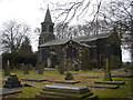
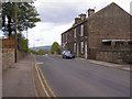
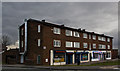
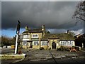
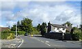
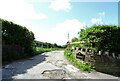
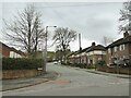
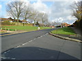
43 photos from this area
Area Information
Key information about the BL2 5HY including its size, population, and administrative classification.
- Area Type
- Postcode
- Area Size
- 1.1 hectares
- Population
- 1708
- Population Density
- 5686 people/km²
House Prices in BL2 5HY
35
Properties
£97,246
Average Sold Price
£52,000
Lowest Price
£180,000
Highest Price
Showing 35 properties
| Address | Type | Beds | Baths | Last Sale Price | Last Sale Date | |
|---|---|---|---|---|---|---|
| 224 Deepdale Road, Bolton, BL2 5HY | Terraced | 3 | 1 | £127,000 | Oct 2023 | |
| 216 Deepdale Road, Bolton, BL2 5HY | Terraced | 2 | 1 | £136,000 | Oct 2023 | |
| 200 Deepdale Road, Bolton, BL2 5HY | house | - | - | £90,000 | Mar 2022 | |
| 198A Deepdale Road, Bolton, BL2 5HY | Detached | 3 | 2 | £180,000 | Apr 2021 | |
| 226 Deepdale Road, Bolton, BL2 5HY | Terraced | 3 | - | £115,000 | Feb 2021 | |
| 187 Deepdale Road, Bolton, BL2 5HY | Semi-detached | 3 | 1 | £89,000 | Oct 2020 | |
| 199 Deepdale Road, Bolton, BL2 5HY | Semi-detached | 3 | 1 | £90,000 | Aug 2020 | |
| 220 Deepdale Road, Bolton, BL2 5HY | Terraced | 2 | 1 | £92,000 | Nov 2019 | |
| 218 Deepdale Road, Bolton, BL2 5HY | Terraced | 2 | 1 | £68,000 | Feb 2019 | |
| 189 Deepdale Road, Bolton, BL2 5HY | house | 2 | - | £52,000 | Apr 2014 |
Page 1 of 4
Energy Efficiency in BL2 5HY
Amenities
Schools
| Rank | School | Type | Entry gender | Ages |
|---|
Explore more schools in this area
Go to Schools tabDemographics
Household Size
One person
most common
Accommodation Type
Houses
most common
Tenure
28
majority
Ethnic Group
White
most common
Religion
N/A
most common
Household Composition
N/A
most common
Age
47
median
Adults (30-64 years)
most common
Household Deprivation
N/A
with no deprivation
NS-SEC
17
in Lower managerial occupations
Explore more demographic insights in this area
Go to Demographics tabPlanning
Planning Constraints
- Flood RiskPremium
- Ramsar Wetland SitesPremium
- Area of Outstanding Natural BeautyPremium
- Protected Nature ReservePremium
- Protected WoodlandPremium