Area Overview for BL2 5FH
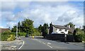
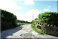
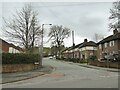
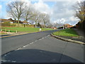
Photos of BL2 5FH
Area Information
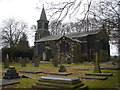
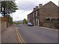
BL2 5FH is a small residential postcode area in England, part of the historic township of Breightmet in Bolton, Greater Manchester. With a population of around 1,523, it reflects a quiet, close-knit community rooted in the region’s textile manufacturing past. Once rural farmland, the area evolved into a residential district, retaining traces of its heritage in landmarks like Roscoe Fold School, built on the site of a 17th-century estate. Daily life here is defined by proximity to local amenities, including retail stores, rail stations, and schools. The area’s compact size means residents can access essential services within walking or cycling distance. While the population is modest, the community is characterised by a mature age profile, with 76% of homes owned by residents. This suggests a stable, long-term presence, though the area’s small scale means it is best suited for those prioritising convenience over expansive living spaces.
- Area Type
- Postcode
- Area Size
- Not available
- Population
- 1523
- Population Density
- 2633 people/km²
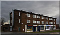
BL2 5FH is predominantly an owner-occupied area, with 76% of homes owned by residents rather than rented. The accommodation type is largely houses, which suggests a focus on single-family dwellings rather than apartments or flats. This housing stock is typical of smaller, historic residential clusters, where properties are often older and may require maintenance. The limited population and small area size mean the housing market is niche, with limited options for buyers. Those considering the area should note that the property stock is unlikely to expand significantly, as the postcode covers only a small cluster of homes. For buyers, this means competition may be low, but the range of properties available will be constrained by the area’s size and historical development patterns.
House Prices in BL2 5FH
No properties found in this postcode.
Energy Efficiency in BL2 5FH
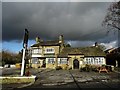
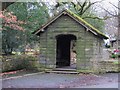
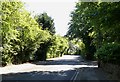
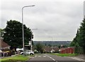
The lifestyle in BL2 5FH is shaped by its proximity to retail, transport, and historical sites. Local shops like Iceland Bolton, Aldi Breightmet, and Spar provide everyday essentials, while nearby rail and metro stations ensure easy access to broader networks. The area’s historical character is evident in landmarks such as Roscoe Fold School, built on the site of a 17th-century estate, and Bradshaw Brook Banks, where remnants of a 19th-century farmstead remain. These features add a unique cultural dimension to daily life. The availability of multiple transport options and retail outlets means residents can enjoy both convenience and a sense of community. For those who appreciate a mix of practicality and heritage, BL2 5FH offers a compact, accessible environment.
Amenities
Schools
The nearest schools to BL2 5FH include Christ’s Church CofE Primary School in Harwood, a primary school, and Firwood High School, which is designated as a special school. Bolton St Catherine’s Academy appears twice in the data, both as an academy with an Ofsted rating of satisfactory. This mix of school types offers families options for different educational needs, though the presence of a special school suggests the area may cater to students with specific learning requirements. The academy’s satisfactory rating indicates it meets basic standards but may not excel in areas like performance or Ofsted inspections. Parents should consider the proximity of these schools to their homes and the specific needs of their children when evaluating the area.
| Rank | School | Type | Entry gender | Ages |
|---|
Explore more schools in this area
Go to Schools tabDemographics
The median age in BL2 5FH is 47, with the majority of residents falling into the 30-64 age range. This indicates a community of working-age adults and older individuals, likely with established careers and family ties. Home ownership is high at 76%, suggesting a strong local presence and investment in property. The predominant accommodation type is houses, which aligns with the area’s traditional residential character. The predominant ethnic group is White, though no data on diversity beyond this is provided. The age profile and home ownership rate imply a stable, low-turnover population, which can influence local services and amenities. However, the lack of specific data on deprivation or income levels means the area’s economic resilience cannot be fully assessed.
Household Size
Accommodation Type
Tenure
Ethnic Group
Religion
Household Composition
Age
Household Deprivation
NS-SEC
Explore more demographic insights in this area
Go to Demographics tabPlanning
Planning Constraints
- Flood RiskPremium
- Ramsar Wetland SitesPremium
- Area of Outstanding Natural BeautyPremium
- Protected Nature ReservePremium
- Protected WoodlandPremium