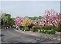
Area Overview for BL2 3RD
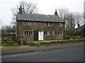
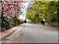
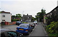
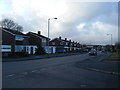
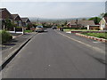
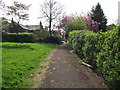
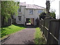
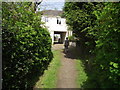
Photos of BL2 3RD

Area Information
BL2 3RD is a small residential postcode area in England, home to around 1,523 people. It occupies a compact footprint, typical of a postcode cluster, and reflects a quiet, established community. The area’s character is shaped by its historical roots in Bolton-le-Moors, a parish with medieval origins. Today, BL2 3RD is a place where households are predominantly owner-occupied, with 76% of homes owned by residents. The median age of 47 suggests a stable population, with adults aged 30–64 forming the majority. Daily life here is defined by proximity to local schools, transport links, and a mix of retail and public services. The area’s small size means residents are close to amenities, though it lacks the density of larger urban centres. Its location within Greater Manchester offers access to broader regional networks, while its historical ties to textile manufacturing and quarrying hint at a working-class heritage. For buyers, BL2 3RD presents a blend of practicality and tradition, with homes primarily in single-family structures. The area’s low flood risk and absence of protected natural sites make it a straightforward place to live, though its safety profile requires attention.
- Area Type
- Postcode
- Area Size
- Not available
- Population
- 1523
- Population Density
- 2633 people/km²
The property market in BL2 3RD is characterised by high home ownership, with 76% of residents owning their homes. This suggests a market skewed towards owner-occupation rather than rentals, which is typical of smaller, established communities. The accommodation type is primarily houses, indicating a focus on single-family homes rather than apartments or terraced properties. This housing stock may appeal to families or individuals seeking space and privacy, though the limited size of the area means the available properties are concentrated within a small geographic footprint. For buyers, this means competition for homes is likely to be local, with limited scope for expansion beyond the immediate vicinity. The absence of high-end or luxury properties suggests a modest market, where affordability and practicality are prioritised over prestige. The predominance of houses also implies that renovation or extension opportunities may be more common than in high-density areas.
House Prices in BL2 3RD
No properties found in this postcode.
Energy Efficiency in BL2 3RD
Daily life in BL2 3RD is supported by a range of nearby amenities. Retailers such as Spar, Morrisons Top O, and Iceland Bolton provide essential shopping, while the proximity of rail stations like Hall i’ th’ Wood and Bromley Cross ensures easy access to larger towns. Metro services at Radcliffe and Bury Interchange connect residents to broader Greater Manchester networks, facilitating travel for work or leisure. The area’s small size means these amenities are within walking or short driving distance, enhancing convenience. While there is no mention of parks or leisure facilities in the data, the presence of schools and transport hubs suggests a focus on practicality over recreational spaces. The mix of retail, transport, and educational options creates a functional, community-oriented environment where residents can meet daily needs without long commutes.
Amenities
Schools
BL2 3RD is served by a range of educational institutions, including Christ’s Church CofE Primary School in Harwood, which provides early years and primary education. Firwood High School, a special school, caters to students with specific educational needs, while Bolton St Catherine’s Academy, an academy, offers secondary education. Notably, Bolton St Catherine’s Academy has an Ofsted rating of satisfactory, reflecting its performance in meeting educational standards. The mix of school types ensures that families have options for both mainstream and specialist education. However, the absence of a clearly outstanding school in the area may be a consideration for parents prioritising high-performing institutions. The proximity of these schools to BL2 3RD means that daily commutes for students are likely to be short, supporting a family-friendly environment.
| Rank | School | Type | Entry gender | Ages |
|---|
Explore more schools in this area
Go to Schools tabDemographics
The population of BL2 3RD is 1,523, with a median age of 47. The majority of residents fall within the 30–64 age range, indicating a mature, settled community. Home ownership is high at 76%, reflecting a preference for long-term residency over rental properties. The accommodation type is predominantly houses, suggesting a mix of semi-detached and detached homes. The predominant ethnic group is White, though specific diversity statistics are not provided. The age profile and ownership rates imply a stable, low-turnover neighbourhood, where families and older adults are the primary demographic. This demographic structure may influence local services and amenities, with schools and retail tailored to adult and family needs. The absence of detailed deprivation data means the area’s quality of life is inferred from its infrastructure and safety assessments. For instance, the high crime risk noted in safety evaluations could impact perceptions of security, even if other factors like broadband connectivity remain strong.
Household Size
Accommodation Type
Tenure
Ethnic Group
Religion
Household Composition
Age
Household Deprivation
NS-SEC
Explore more demographic insights in this area
Go to Demographics tabPlanning
Planning Constraints
- Flood RiskPremium
- Ramsar Wetland SitesPremium
- Area of Outstanding Natural BeautyPremium
- Protected Nature ReservePremium
- Protected WoodlandPremium