Area Overview for BL2 1DU
Photos of BL2 1DU
Area Information
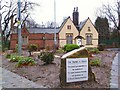
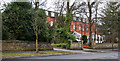
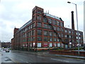
BL2 1DU represents a compact residential cluster within Bolton, Greater Manchester, covering exactly 1.5 hectares and home to 2,090 residents. While the postcode itself marks a small geographical footprint, it sits within the broader context of Queen's Park, a 22-acre Victorian public park established in 1866 on land north-west of Bolton town centre. The park was originally named Bolton Park before renaming in 1897 to celebrate Queen Victoria's Diamond Jubilee, featuring Grade II listed statues and neolithic historical finds nearby. Living in BL2 1DU means occupying a space where population density reaches 135,793 people per square kilometre, indicating a high-urban character typical of Bolton. Despite the dense settlement, the area offers direct access to heritage sites like the former Chadwick Museum grounds and the River Croal which runs through the lower section of the park. Residents benefit from proximity to Chorley New Road and the heritage park which was designed by William Henderson. This location combines the convenience of a built-up environment with immediate access to green spaces created during the Victorian era. The area serves as a practical base for those working in Bolton or commuting to Manchester, offering a mix of residential density and historic charm without the vast expanses of suburban development.
- Area Type
- Postcode
- Area Size
- 1.5 hectares
- Population
- 2090
- Population Density
- 2396 people/km²
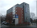
Homes in BL2 1DU are defined by a significant reliance on rental accommodation, with only 15% of the housing stock classified as owned homes. The area is dominated by flats, a property type that suits the high population density of 135,793 people per square kilometre found within the 1.5 hectare postcode boundary. This configuration offers high-convenience living for those who prioritise location over gardens or standalone houses. The low home ownership rate suggests that buyers looking for detached or semi-detached properties in BL2 1DU may face limited options or higher competition compared to older, owner-occupied estates. Prospective homeowners should consider that entry into this market often involves purchasing a flat within a block of similar units rather than a freehold family home. The area caters to individuals and couples seeking urban lifestyles without the maintenance burdens associated with larger properties. For investors or landlords, the dense flat focus presents an opportunity consistent with the local demographic of renters. When searching for homes in this postcode, buyers must prioritise location and immediate amenities over extensive grounds, as the land area restricts traditional suburban development models.
House Prices in BL2 1DU
No properties found in this postcode.
Energy Efficiency in BL2 1DU
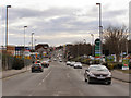
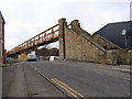
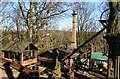
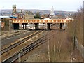
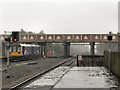
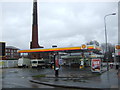
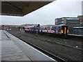
Residents of BL2 1DU enjoy convenient access to major retail anchors and transport hubs within a short travel time. Five retail venues operate nearby, including Iceland Bolton and Lidl Bolton, which provide essential grocery shopping without the need to enter city centre congestion. Asda Burnden also serves the wider locality, offering additional supermarket choice. Transport connectivity includes five railway stations and five metro stops, facilitating easy movement to Radcliffe, Bury, and beyond. Queen's Park lies directly adjacent to the area, offering Victorian flowerbeds, duck ponds, tennis courts, and Grade II listed statues of Benjamin Disraeli and John Fielding. The park features a sunken garden and a listed entrance lodge now operating as a cafe, providing leisure and dining options. Historic elements like the stone fountain and cenotaph add cultural depth to the daily walks. The census data confirms no restrictions on Ramsar sites or areas of outstanding natural beauty, ensuring open park access. Shopping trips at Lidl or Iceland are complemented by strolls through the historic bandstand and play areas. This blend of urban retail and Victorian heritage creates a balanced lifestyle environment.
Amenities
Schools
Families living in BL2 1DU have access to four key educational institutions within the immediate vicinity. St Peter and St Paul RC Primary School holds an Ofsted rating of good, offering primary education for younger children in the community. The area also hosts Bolton Sixth Form College, catering to older students pursuing post-16 education and further qualifications. Additional local options include The Young Mums Unit and Premier Training, which provide alternative vocational and support services rather than academic schooling. This mix of institutions means that parents do not need to travel far for primary education, with primary schooling situated close to home. The presence of a sixth form college allows family members of all ages to access education locally, reducing commute times. While the area does not feature a secondary school in the immediate list, the sixth form college serves as a critical hub for adolescents. Residents should plan route maps to include these specific named schools to ensure their children attend institutions within practical commuting distance. The concentration of educational facilities supports the adult population priorities while maintaining access for younger demographics.
| Rank | School | Type | Entry gender | Ages |
|---|
Explore more schools in this area
Go to Schools tabDemographics
The community living in BL2 1DU reflects a mature demographic profile, with a median age of 47 years. Adults aged between 30 and 64 years constitute the most common age range, suggesting a neighbourhood where families with older children or empty nesters reside alongside established professionals. Housing is characterised primarily by flats, which aligns with the high-density nature of the postcode area. Home ownership stands at only 15%, meaning the vast majority of residents rent rather than own their properties. This statistic indicates a dynamic rental market where tenants cycle through accommodation frequently compared to long-term owner-run households. The predominant ethnic group is White, though the area benefits from the diversity inherent in Greater Manchester's urban centres. With a population of 2,090 people packed into 1.5 hectares, the atmosphere remains tight-knit despite the urban intensity. This density creates a distinct living environment where neighbours are often close physically, even if homeownership is uncommon. The low ownership rate contrasts with areas where families build generational wealth through property, making this a hub for private rental tenants seeking convenience and central locations in Bolton.
Household Size
Accommodation Type
Tenure
Ethnic Group
Religion
Household Composition
Age
Household Deprivation
NS-SEC
Explore more demographic insights in this area
Go to Demographics tabPlanning
Planning Constraints
- Flood RiskPremium
- Ramsar Wetland SitesPremium
- Area of Outstanding Natural BeautyPremium
- Protected Nature ReservePremium
- Protected WoodlandPremium