Area Overview for BL1 8EA
Photos of BL1 8EA

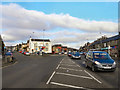
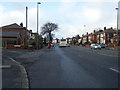
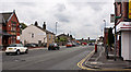
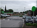
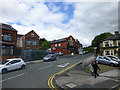
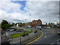
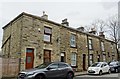
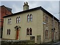
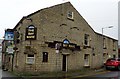
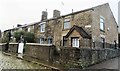
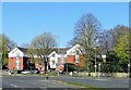
69 photos from this area
Area Information
Key information about the BL1 8EA including its size, population, and administrative classification.
- Area Type
- Postcode
- Area Size
- 2.1 hectares
- Population
- 1971
- Population Density
- 12182 people/km²
House Prices in BL1 8EA
40
Properties
£56,953
Average Sold Price
£485
Lowest Price
£147,000
Highest Price
Showing 40 properties
| Address | Type | Beds | Baths | Last Sale Price | Last Sale Date | |
|---|---|---|---|---|---|---|
| 16 Eckersley Road, Bolton, BL1 8EA | house | - | - | £139,500 | Jul 2024 | |
| 3 Eckersley Road, Bolton, BL1 8EA | Terraced | 5 | 3 | £485 | Mar 2023 | |
| 3 Eckersley Road, Bolton, BL1 8EA | Terraced | - | - | £485 | Mar 2023 | |
| 8 Eckersley Road, Bolton, BL1 8EA | house | - | - | £147,000 | Sep 2020 | |
| 6 Eckersley Road, Bolton, BL1 8EA | house | - | - | £120,000 | Aug 2020 | |
| 14 Eckersley Road, Bolton, BL1 8EA | house | 4 | - | £110,000 | May 2019 | |
| 30 Eckersley Road, Bolton, BL1 8EA | house | 3 | 1 | £95,000 | Oct 2016 | |
| 48 Eckersley Road, Bolton, BL1 8EA | house | - | - | £42,000 | Jan 2012 | |
| 54 Eckersley Road, Bolton, BL1 8EA | Terraced | 4 | 2 | £55,000 | Jul 2011 | |
| 11 Eckersley Road, Bolton, BL1 8EA | house | - | - | £105,000 | Dec 2010 |
Page 1 of 4
Energy Efficiency in BL1 8EA
Amenities
Schools
| Rank | School | Type | Entry gender | Ages |
|---|
Explore more schools in this area
Go to Schools tabDemographics
Household Size
Family (3-5 people)
most common
Accommodation Type
Houses
most common
Tenure
42
majority
Ethnic Group
asian_total
most common
Religion
N/A
most common
Household Composition
N/A
most common
Age
47
median
Adults (30-64 years)
most common
Household Deprivation
N/A
with no deprivation
NS-SEC
11
in Lower managerial occupations
Explore more demographic insights in this area
Go to Demographics tabPlanning
Planning Constraints
- Flood RiskPremium
- Ramsar Wetland SitesPremium
- Area of Outstanding Natural BeautyPremium
- Protected Nature ReservePremium
- Protected WoodlandPremium