Area Overview for BL1 5HF
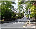
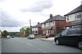
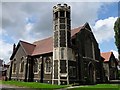
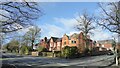
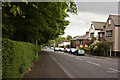
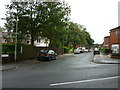
Photos of BL1 5HF


Area Information
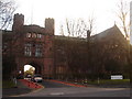
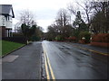
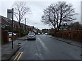
BL1 5HF is a compact residential postcode in the Heaton, Lostock & Chew Moor Ward of Bolton, Greater Manchester. Covering just 1.4 hectares, it is densely populated, with 1,872 residents living at a density of 130,260 people per square kilometre. The area is historically rooted, with names like Lostock deriving from Old English and Chew Moor dating to the 12th century. It lies 3.5 miles west of Bolton town centre and 13 miles northwest of Manchester, placing it at the edge of Greater Manchester’s suburban sprawl. The ward includes Lostock, Heaton, and Chew Moor, with landmarks such as the Grade II* listed Lostock Hall gatehouse and the University of Bolton Stadium. Daily life here is shaped by its proximity to rail networks and retail hubs, while the character of the area blends suburban tranquillity with historical layers. The population is predominantly middle-aged, with a strong presence of single-person households and families with children, reflecting a community that balances independence with domestic stability.
- Area Type
- Postcode
- Area Size
- 1.4 hectares
- Population
- 1872
- Population Density
- 3678 people/km²
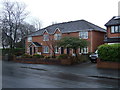
BL1 5HF is a largely owner-occupied area, with 74% of homes owned by residents rather than rented. The accommodation type is predominantly houses, which is typical of suburban settings and contrasts with urban areas where flats dominate. This suggests a housing stock that prioritises family-friendly, standalone properties. Given the area’s small size—just 1.4 hectares—and high population density, the housing market is likely limited to the immediate vicinity. Buyers should consider nearby wards for additional options, as the area itself is a small cluster of homes. The high home ownership rate indicates a stable market, but the lack of rental properties suggests limited flexibility for those seeking tenancies. The presence of houses may appeal to those seeking space and privacy, though proximity to transport links and amenities is a key selling point.
House Prices in BL1 5HF
Showing 16 properties
| Address | Type | Beds | Baths | Last Sale Price | Last Sale Date | |
|---|---|---|---|---|---|---|
| 22 Albert Road, Bolton, BL1 5HF | house | - | - | £270,000 | Sep 2021 | |
| 25 Albert Road, Bolton, BL1 5HF | Semi-detached | 6 | - | £575,200 | Nov 2020 | |
| Elsinore House, 32 Albert Road, Bolton, BL1 5HF | Semi-detached | 6 | - | £555,000 | Feb 2016 | |
| 31 Albert Road, Bolton, BL1 5HF | Semi-detached | 6 | - | £356,500 | Jan 2015 | |
| 28 Albert Road, Bolton, BL1 5HF | Semi-detached | 8 | 5 | £649,995 | Jun 2014 | |
| 26 Albert Road, Bolton, BL1 5HF | house | 6 | - | £437,500 | Aug 2011 | |
| 23 Albert Road, Bolton, BL1 5HF | Detached | - | - | £450,000 | Nov 2009 | |
| Breve House, 33 Albert Road, Bolton, BL1 5HF | Semi-detached | 6 | 3 | £425,000 | Sep 2006 | |
| 30 Albert Road, Bolton, BL1 5HF | house | - | - | £249,500 | May 2004 | |
| 34 Albert Road, Bolton, BL1 5HF | house | - | - | £249,000 | Jan 2002 |
Energy Efficiency in BL1 5HF
Living in BL1 5HF offers access to a range of amenities within practical reach. Retail options include Morrisons Halliwell, Tesco Bolton Wigan, and Spar, providing daily essentials. The area’s rail stations—Lostock, Bolton, and Hall i’ th’ Wood—offer easy access to nearby towns and cities, while the Radcliffe metro station enhances regional connectivity. Though the data does not specify parks or leisure facilities, the presence of historical landmarks like the Church of St Mary and Random Cottage suggests a mix of cultural and architectural interest. The suburban setting, combined with retail and transport links, creates a lifestyle that balances convenience with a sense of community. Residents can enjoy local shops, efficient transport, and the quietude of a residential area without sacrificing accessibility to larger urban hubs.
Amenities
Schools
| Rank | School | Type | Entry gender | Ages |
|---|
Explore more schools in this area
Go to Schools tabDemographics
The median age in BL1 5HF is 47, with the most common age range being adults aged 30–64. This suggests a community of established residents, many of whom may be in their prime working years or nearing retirement. Home ownership is high at 74%, indicating a stable, long-term population. The area is primarily composed of houses, with no mention of flats or apartments, reflecting a suburban rather than urban housing profile. Ethnically, 69% of residents identify as White, 26% as Asian, and 1% as Black, highlighting a diverse but predominantly White demographic. The ward’s character includes 26% single-person households and 29% with dependent children, suggesting a mix of independent living and family units. This blend of household types, combined with the age distribution, points to a community that balances generational needs.
Household Size
Accommodation Type
Tenure
Ethnic Group
Religion
Household Composition
Age
Household Deprivation
NS-SEC
Explore more demographic insights in this area
Go to Demographics tabPlanning
Planning Constraints
- Flood RiskPremium
- Ramsar Wetland SitesPremium
- Area of Outstanding Natural BeautyPremium
- Protected Nature ReservePremium
- Protected WoodlandPremium