Area Overview for BL1 4TB
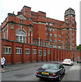
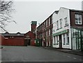
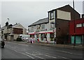
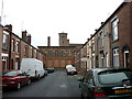
Photos of BL1 4TB


Area Information
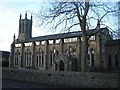
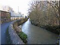
BL1 4TB is a compact residential postcode in England, covering 5,987 square metres and home to 1,227 people. Its high population density of 204,936 people per square kilometre reflects a tightly knit community, though the area’s small size means it is best suited for those prioritising proximity to local amenities over expansive living space. The area is anchored by Queen’s Park, a Victorian public park established in 1866, which offers historical and recreational value. This park, with its duck ponds, sunken gardens, and Grade II listed statues, is a focal point for residents. BL1 4TB lies within Greater Manchester, close to Bolton town centre, and benefits from nearby rail and metro connections. The demographic profile suggests a mature population, with a median age of 47 and most residents aged 30–64. While the area is not defined by natural beauty or protected landscapes, its compact design and proximity to urban infrastructure make it a practical choice for commuters and those seeking a quiet residential enclave with accessible services.
- Area Type
- Postcode
- Area Size
- 5987 m²
- Population
- Not available
- Population Density
- Not available
BL1 4TB is characterised by a rental-driven property market, with only 10% of residents owning their homes. The accommodation type is almost exclusively flats, a reflection of the area’s small footprint and high population density. This suggests a limited supply of larger homes or detached properties, making the area more suitable for those seeking affordable, compact living rather than investment opportunities. The high proportion of renters may indicate a transient population or a lack of long-term housing options. For buyers, the small size of the postcode means the housing stock is tightly concentrated, with little scope for expansion. Proximity to rail and metro stations, however, could offset the area’s limitations, appealing to commuters or those prioritising transport links over property size.
House Prices in BL1 4TB
No properties found in this postcode.
Energy Efficiency in BL1 4TB
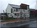
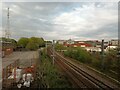
Daily life in BL1 4TB is shaped by its compact layout and nearby amenities. The area includes five retail venues, such as Spar, Lidl Daubhill, and Aldi Great, offering convenience for groceries and essentials. Rail and metro stations provide seamless access to urban hubs, with Bolton Railway Station and Bury metro stops within practical reach. While the area lacks dedicated parks within its postcode, Queen’s Park—a 22-acre Victorian park—lies nearby, offering recreational space with duck ponds, gardens, and historical landmarks. The mix of retail, transport, and green space supports a functional lifestyle, though the limited number of amenities may require residents to travel slightly for more specialised services. The area’s density fosters a community-oriented environment, with shared spaces and local shops contributing to a sense of cohesion.
Amenities
Schools
The only school listed near BL1 4TB is A.CofE Project, categorised as an “other” type. No Ofsted rating is provided in the data, so its educational standards or performance cannot be assessed here. The absence of multiple schools suggests limited options for families, though the area’s proximity to Bolton town centre may offer access to additional educational institutions beyond the immediate postcode. For parents prioritising school choice, BL1 4TB’s limited local provision could necessitate commuting to nearby districts. The single listed school may indicate a focus on community-based education or specialised provision, but without further details, its role in the area’s appeal remains unclear.
| Rank | School | Type | Entry gender | Ages |
|---|
Explore more schools in this area
Go to Schools tabDemographics
The community in BL1 4TB is predominantly composed of adults aged 30–64, with a median age of 47. Only 10% of residents own their homes, indicating a rental-dominated market. The accommodation type is largely flats, reflecting the area’s high density and limited space for larger properties. The predominant ethnic group is White, though specific data on diversity or deprivation levels is not provided. The age profile suggests a stable, established population, potentially with a focus on long-term residency. The low home ownership rate may imply limited opportunities for property investment or equity growth, which could influence quality of life for renters. The area’s compact size and high density also mean shared resources and communal spaces are central to daily life, with Queen’s Park serving as a key public amenity.
Household Size
Accommodation Type
Tenure
Ethnic Group
Religion
Household Composition
Age
Household Deprivation
NS-SEC
Explore more demographic insights in this area
Go to Demographics tabPlanning
Planning Constraints
- Flood RiskPremium
- Ramsar Wetland SitesPremium
- Area of Outstanding Natural BeautyPremium
- Protected Nature ReservePremium
- Protected WoodlandPremium