Area Overview for BL1 4PJ
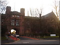
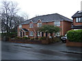
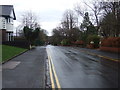
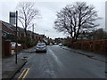
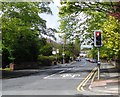
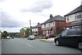
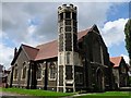
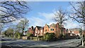
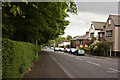
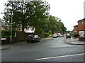
Photos of BL1 4PJ


Area Information
BL1 4PJ is a compact residential postcode in Bolton, Greater Manchester, encompassing a small cluster of homes spread over 2580 m². With a population of 1675, it is densely populated, reflecting a tight-knit community. The area’s historical roots are evident in its proximity to Smithills Hall, a Grade I listed manor house dating back to the 14th century. This blend of heritage and modern living defines the character of BL1 4PJ, where residents benefit from proximity to local amenities and transport links. Daily life here is shaped by the surrounding infrastructure, including nearby rail stations and a mix of retail outlets. The area’s compact size means residents are close to essential services, though the high population density can influence the pace of life. For those seeking a balance between history and convenience, BL1 4PJ offers a distinct identity within the broader Bolton landscape.
- Area Type
- Postcode
- Area Size
- 2580 m²
- Population
- 1675
- Population Density
- 9953 people/km²
The property market in BL1 4PJ is predominantly owner-occupied, with 63% of homes owned by residents rather than rented. The accommodation type is largely houses, reflecting a traditional residential layout. Given the area’s small size and high population density, the housing stock is limited, which may create competition among buyers. The focus on owner-occupied properties suggests a long-term investment outlook, with residents likely prioritising stability over short-term rental opportunities. For prospective buyers, the compact nature of the area means that properties are closely spaced, and the immediate surroundings offer few alternatives. This could make the market competitive, with buyers needing to act swiftly to secure a home. The dominance of houses also implies limited availability of flats or apartments, which may be a consideration for those seeking different housing types.
House Prices in BL1 4PJ
Showing 1 properties
| Address | Type | Beds | Baths | Last Sale Price | Last Sale Date | |
|---|---|---|---|---|---|---|
| Thomasson Memorial School, Devonshire Road, Bolton, BL1 4PJ | commercial | - | - | - | - |
Energy Efficiency in BL1 4PJ
Living in BL1 4PJ offers access to a range of nearby amenities, including five retail outlets such as Morrisons Halliwell, Tesco Bolton Wigan, and Spar. These provide essential shopping and grocery needs within practical reach. The area’s proximity to rail stations and the Radcliffe Metro station enhances mobility, making it easy to access broader leisure and employment opportunities. While parks and recreational spaces are not explicitly mentioned in the data, the historical context of Smithills Hall suggests cultural and heritage sites may be nearby. The combination of retail options and transport links contributes to a convenient lifestyle, where daily necessities are accessible without long commutes. This balance of practical amenities and connectivity supports a functional, community-focused way of life.
Amenities
Schools
The nearest school to BL1 4PJ is Devonshire Road Primary School, which serves the local community with a primary education offering. The school holds an Ofsted rating of ‘good’, indicating a satisfactory standard of teaching and facilities. As the only named school in the area, it is the primary educational option for young residents. The absence of secondary schools or other educational institutions within the immediate vicinity means families may need to travel to nearby areas for higher education. However, the presence of a well-rated primary school is a positive factor for families prioritising early education. The single school in the area underscores the need for broader transport links to access other educational stages, though the local primary school provides a solid foundation for younger children.
| Rank | School | Type | Entry gender | Ages |
|---|
Explore more schools in this area
Go to Schools tabDemographics
The population of BL1 4PJ has a median age of 47, with the majority of residents falling within the 30-64 age range. This suggests a community skewed toward middle-aged adults, likely with established careers and families. Home ownership in the area stands at 63%, indicating a stable housing market where most residents own their properties. The predominant accommodation type is houses, which aligns with the area’s residential character. The dominant ethnic group is White, though specific diversity metrics are not provided. The high proportion of homeowners and the age profile suggest a settled population, potentially with fewer transient residents. This demographic structure may influence local services and amenities, tailored to the needs of a mature, family-oriented community.
Household Size
Accommodation Type
Tenure
Ethnic Group
Religion
Household Composition
Age
Household Deprivation
NS-SEC
Explore more demographic insights in this area
Go to Demographics tabPlanning
Planning Constraints
- Flood RiskPremium
- Ramsar Wetland SitesPremium
- Area of Outstanding Natural BeautyPremium
- Protected Nature ReservePremium
- Protected WoodlandPremium