Area Overview for BL1 4DS
Photos of BL1 4DS
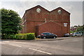
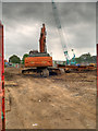
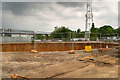
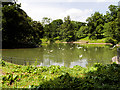
94 photos from this area
Area Information
Key information about the BL1 4DS including its size, population, and administrative classification.
- Area Type
- Postcode
- Area Size
- 5177 m²
- Population
- 2163
- Population Density
- 11432 people/km²
House Prices in BL1 4DS
44
Properties
£70,845
Average Sold Price
£7,000
Lowest Price
£144,000
Highest Price
Showing 44 properties
| Address | Type | Beds | Baths | Last Sale Price | Last Sale Date | |
|---|---|---|---|---|---|---|
| 15 Kendal Road, Bolton, BL1 4DS | Terraced | 2 | 1 | £144,000 | Jul 2025 | |
| 30 Kendal Road, Bolton, BL1 4DS | Terraced | 3 | 1 | £140,000 | May 2025 | |
| 17 Kendal Road, Bolton, BL1 4DS | Terraced | 2 | 1 | £85,000 | Sep 2024 | |
| 40 Kendal Road, Bolton, BL1 4DS | house | 2 | - | £85,000 | Dec 2023 | |
| 33 Kendal Road, Bolton, BL1 4DS | Terraced | 2 | 1 | £126,000 | Jul 2023 | |
| 14 Kendal Road, Bolton, BL1 4DS | house | - | - | £90,000 | Mar 2023 | |
| 21 Kendal Road, Bolton, BL1 4DS | Terraced | 2 | 1 | £122,000 | Oct 2022 | |
| 39 Kendal Road, Bolton, BL1 4DS | Terraced | 2 | 1 | £132,000 | Sep 2022 | |
| 43 Kendal Road, Bolton, BL1 4DS | Terraced | 2 | 1 | £105,000 | May 2022 | |
| 25 Kendal Road, Bolton, BL1 4DS | house | - | - | £83,500 | Oct 2021 |
Page 1 of 5
Energy Efficiency in BL1 4DS
Amenities
Schools
| Rank | School | Type | Entry gender | Ages |
|---|
Explore more schools in this area
Go to Schools tabDemographics
Household Size
Family (3-5 people)
most common
Accommodation Type
Houses
most common
Tenure
47
majority
Ethnic Group
asian_total
most common
Religion
N/A
most common
Household Composition
N/A
most common
Age
47
median
Adults (30-64 years)
most common
Household Deprivation
N/A
with no deprivation
NS-SEC
14
in Lower managerial occupations
Explore more demographic insights in this area
Go to Demographics tabPlanning
Planning Constraints
- Flood RiskPremium
- Ramsar Wetland SitesPremium
- Area of Outstanding Natural BeautyPremium
- Protected Nature ReservePremium
- Protected WoodlandPremium