Area Overview for BL1 4BT
Photos of BL1 4BT
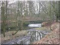
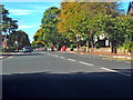
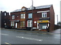
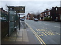
94 photos from this area
Area Information
Key information about the BL1 4BT including its size, population, and administrative classification.
- Area Type
- Postcode
- Area Size
- 5600 m²
- Population
- 2015
- Population Density
- 6369 people/km²
House Prices in BL1 4BT
15
Properties
£92,200
Average Sold Price
£27,500
Lowest Price
£137,000
Highest Price
Showing 15 properties
| Address | Type | Beds | Baths | Last Sale Price | Last Sale Date | |
|---|---|---|---|---|---|---|
| 12 Carslake Avenue, Bolton, BL1 4BT | house | 3 | 1 | £120,000 | Apr 2021 | |
| 10 Carslake Avenue, Bolton, BL1 4BT | Terraced | 3 | 1 | £74,500 | Dec 2019 | |
| 39 Carslake Avenue, Bolton, BL1 4BT | Semi-detached | 3 | 1 | £118,000 | Jul 2017 | |
| 33 Carslake Avenue, Bolton, BL1 4BT | Terraced | 3 | 1 | £111,000 | Jun 2017 | |
| 6 Carslake Avenue, Bolton, BL1 4BT | house | 3 | - | £88,000 | Oct 2014 | |
| 35 Carslake Avenue, Bolton, BL1 4BT | house | 4 | - | £101,300 | Oct 2012 | |
| 25 Carslake Avenue, Bolton, BL1 4BT | Semi-detached | 3 | 1 | £137,000 | Jul 2007 | |
| 41 Carslake Avenue, Bolton, BL1 4BT | Terraced | - | - | £52,500 | Nov 1998 | |
| 2 Carslake Avenue, Bolton, BL1 4BT | Terraced | 3 | 1 | £27,500 | Sep 1995 | |
| 4 Carslake Avenue, Bolton, BL1 4BT | Semi-detached | 3 | 1 | - | - |
Page 1 of 2
Energy Efficiency in BL1 4BT
Amenities
Schools
| Rank | School | Type | Entry gender | Ages |
|---|
Explore more schools in this area
Go to Schools tabDemographics
Household Size
One person
most common
Accommodation Type
Houses
most common
Tenure
41
majority
Ethnic Group
asian_total
most common
Religion
N/A
most common
Household Composition
N/A
most common
Age
47
median
Adults (30-64 years)
most common
Household Deprivation
N/A
with no deprivation
NS-SEC
17
in Lower managerial occupations
Explore more demographic insights in this area
Go to Demographics tabPlanning
Planning Constraints
- Flood RiskPremium
- Ramsar Wetland SitesPremium
- Area of Outstanding Natural BeautyPremium
- Protected Nature ReservePremium
- Protected WoodlandPremium