Area Overview for BL1 4BF
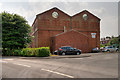
Photos of BL1 4BF
Area Information
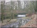
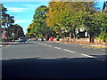
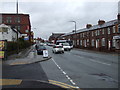
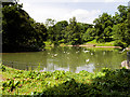
BL1 4BF is a small, tightly knit residential postcode in Bolton, Greater Manchester, with a population of just over 2,000 people. Situated near Queen’s Park, a historic Victorian green space, the area blends urban convenience with pockets of natural heritage. The park, established in 1866, offers walking paths, duck ponds, and historic statues, providing a focal point for local leisure. Daily life here is shaped by proximity to retail hubs like Morrisons Halliwell and Tesco Bolton Wigan, as well as rail links to Bolton, Lostock, and Hall i’ th’ Wood stations. The community is predominantly middle-aged, with a strong presence of Asian residents, and reflects a mix of owner-occupied and rental homes. While the area lacks large-scale infrastructure, its compact size ensures amenities are within walking or short driving distance. For those seeking a quieter lifestyle with access to transport and green spaces, BL1 4BF offers a balance of practicality and charm, though its small footprint means it’s best suited for those prioritising convenience over expansive living.
- Area Type
- Postcode
- Area Size
- Not available
- Population
- 2015
- Population Density
- 6369 people/km²
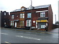
BL1 4BF’s property market is defined by its mix of owner-occupied and rental homes, with 41% of residents owning their properties. The area’s housing stock is predominantly houses, which is atypical for a postcode of this scale, suggesting a focus on family-friendly living. This rarity of houses in urban zones may make the area attractive to buyers seeking space, though the small population and limited development potential mean the market is likely constrained. The compact nature of BL1 4BF means property values could be influenced by proximity to key amenities like Queen’s Park and rail links. For buyers, the challenge lies in navigating a limited inventory, but the presence of houses may offer long-term value for those prioritising home ownership over high-density living.
House Prices in BL1 4BF
No properties found in this postcode.
Energy Efficiency in BL1 4BF
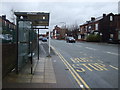
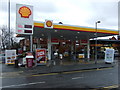
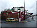
BL1 4BF’s lifestyle is shaped by its proximity to Queen’s Park, a 22-acre Victorian green space with duck ponds, tennis courts, and historic statues. Nearby, residents can access retail outlets such as Morrisons Halliwell, Spar, and Tesco Bolton Wigan, ensuring daily essentials are within reach. The rail network, with five stations in the vicinity, connects the area to Bolton town centre and beyond, while the Radcliffe metro station offers further links. The presence of both independent and retail amenities suggests a practical, community-focused environment. However, the lack of large supermarkets or cultural hubs may require trips to nearby towns for more specialised needs. The area’s compact size ensures a balance between urban convenience and green space, though its small footprint limits the range of on-site facilities.
Amenities
Schools
The nearest school to BL1 4BF is Bolton School Boys’ Division, an independent institution. While no Ofsted rating is provided, independent schools often cater to families seeking structured education and extracurricular opportunities. The absence of state schools in the immediate vicinity may mean families need to travel further for other educational options. This mix of school types reflects a community where private education is accessible, though it may not suit those prioritising public schooling. Parents considering BL1 4BF should factor in the need for additional transport arrangements if their preferred school type differs from what’s available locally.
| Rank | School | Type | Entry gender | Ages |
|---|
Explore more schools in this area
Go to Schools tabDemographics
The population of BL1 4BF has a median age of 47, with the majority of residents aged between 30 and 64. This suggests a community of established professionals and families, though the absence of younger demographics may influence local services and social dynamics. Home ownership rates stand at 41%, indicating a significant proportion of residents rent their homes, which could reflect economic pressures or the area’s appeal as a secondary residence. The predominant accommodation type is houses, which is uncommon in urban settings, hinting at a more suburban character despite its city location. The Asian_total ethnic group forms the largest demographic, contributing to the area’s cultural diversity. While no specific deprivation data is provided, the mix of age groups and housing types suggests a community that balances stability with adaptability.
Household Size
Accommodation Type
Tenure
Ethnic Group
Religion
Household Composition
Age
Household Deprivation
NS-SEC
Explore more demographic insights in this area
Go to Demographics tabPlanning
Planning Constraints
- Flood RiskPremium
- Ramsar Wetland SitesPremium
- Area of Outstanding Natural BeautyPremium
- Protected Nature ReservePremium
- Protected WoodlandPremium