Area Overview for BL1 4AS
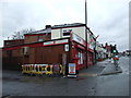
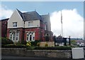
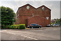
Photos of BL1 4AS


Area Information
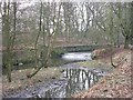
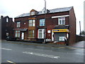
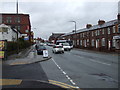
BL1 4AS is a small residential postcode in Bolton, England, with a population of 2015. It is part of a compact cluster of homes, reflecting a quiet, tightly knit community. The area is closely linked to Queen’s Park, a 22-acre Victorian heritage site established in 1866. This park, situated near Chorley New Road, features historic statues, duck ponds, and sunken gardens, offering residents a blend of leisure and green space. Daily life here is shaped by proximity to local amenities and the park’s cultural significance. The area’s history as a site of 19th-century public works, including its construction during the cotton famine, adds to its character. While the population is modest, the area’s infrastructure, including nearby rail links and retail options, supports a practical lifestyle. BL1 4AS is not a large suburb but a defined postcode with a clear sense of place, anchored by its heritage and community-focused amenities.
- Area Type
- Postcode
- Area Size
- Not available
- Population
- 2015
- Population Density
- 6369 people/km²
BL1 4AS is a small area with a limited number of properties, most of which are houses rather than flats. The home ownership rate of 41% indicates that nearly half of the properties are rented, suggesting a market where both owner-occupiers and renters coexist. The predominance of houses may appeal to families or individuals seeking more space, but the small size of the postcode means the housing stock is not extensive. Buyers considering this area should note the limited availability of properties, which could lead to competition. The mix of ownership and rental properties also means that the local real estate market is not exclusively focused on long-term investment. Given the area’s proximity to amenities and transport links, it may attract buyers looking for a balance between residential tranquility and accessibility to services.
House Prices in BL1 4AS
No properties found in this postcode.
Energy Efficiency in BL1 4AS
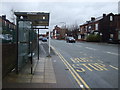
Residents of BL1 4AS have access to a range of amenities within practical reach. The area is near five retail outlets, including Morrisons Halliwell, Morrisons Daily, and Aldi Halliwell, ensuring everyday shopping needs are met. For leisure, Queen’s Park offers Victorian-era features such as duck ponds, sunken gardens, and a children’s play area, providing a green space for recreation. The park’s historical significance, including its Grade II listed statues and a cenotaph, adds cultural value. Nearby rail and metro stations connect residents to broader networks, enhancing convenience. The mix of retail, transport, and green space supports a lifestyle that balances practicality with access to heritage and community facilities. The area’s compact size means amenities are closely clustered, reducing the need for long commutes.
Amenities
Schools
The nearest school to BL1 4AS is Bolton School Boys’ Division, an independent institution. This school is part of a broader network but is not listed with an Ofsted rating in the provided data. The presence of an independent school suggests that the area may cater to families seeking private education, though the limited number of schools in the vicinity means that options are constrained. For families requiring state education, the data does not specify other schools, but the area’s proximity to Bolton town centre may provide access to additional options. The absence of comprehensive school data implies that prospective homebuyers should investigate further to understand the full range of educational opportunities available to children in the area.
| Rank | School | Type | Entry gender | Ages |
|---|
Explore more schools in this area
Go to Schools tabDemographics
The population of BL1 4AS has a median age of 47, with the majority of residents aged between 30 and 64. This suggests a mature, settled community with a focus on family life or established careers. Home ownership in the area is 41%, indicating a mix of owner-occupied and rental properties. The predominant accommodation type is houses, which is unusual for a small postcode but may reflect the area’s historical development. The predominant ethnic group is Asian, which influences the cultural fabric of the neighbourhood. This demographic profile suggests a community that values stability and long-term residence. The lower home ownership rate could imply a higher proportion of younger professionals or families renting in the area. The age range also suggests a population that may be less reliant on local schools for younger children, though this is not explicitly supported by data.
Household Size
Accommodation Type
Tenure
Ethnic Group
Religion
Household Composition
Age
Household Deprivation
NS-SEC
Explore more demographic insights in this area
Go to Demographics tabPlanning
Planning Constraints
- Flood RiskPremium
- Ramsar Wetland SitesPremium
- Area of Outstanding Natural BeautyPremium
- Protected Nature ReservePremium
- Protected WoodlandPremium