Area Overview for BL1 3EQ
Photos of BL1 3EQ
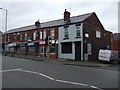
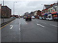
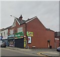
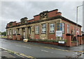
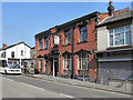
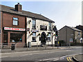
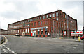
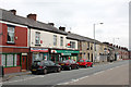
38 photos from this area
Area Information
Key information about the BL1 3EQ including its size, population, and administrative classification.
- Area Type
- Postcode
- Area Size
- 2484 m²
- Population
- 1551
- Population Density
- 8513 people/km²
House Prices in BL1 3EQ
22
Properties
£53,923
Average Sold Price
£20,500
Lowest Price
£113,000
Highest Price
Showing 22 properties
| Address | Type | Beds | Baths | Last Sale Price | Last Sale Date | |
|---|---|---|---|---|---|---|
| 73 Raphael Street, Bolton, BL1 3EQ | Retail | 2 | 1 | £113,000 | Aug 2023 | |
| 59 Raphael Street, Bolton, BL1 3EQ | Terraced | - | - | £50,000 | Sep 2015 | |
| 53 Raphael Street, Bolton, BL1 3EQ | Terraced | 2 | 1 | £50,000 | Feb 2015 | |
| 49 Raphael Street, Bolton, BL1 3EQ | Terraced | - | - | £40,000 | Feb 2014 | |
| 79 Raphael Street, Bolton, BL1 3EQ | house | - | - | £54,500 | Oct 2013 | |
| 67 Raphael Street, Bolton, BL1 3EQ | house | 2 | - | £41,000 | Sep 2010 | |
| 75 Raphael Street, Bolton, BL1 3EQ | Terraced | - | - | £60,000 | May 2008 | |
| 51 Raphael Street, Bolton, BL1 3EQ | house | - | - | £59,000 | Apr 2007 | |
| 55 Raphael Street, Bolton, BL1 3EQ | house | - | - | £22,500 | Sep 2006 | |
| 77 Raphael Street, Bolton, BL1 3EQ | Terraced | 2 | - | £83,000 | Jul 2006 |
Page 1 of 3
Energy Efficiency in BL1 3EQ
Amenities
Schools
| Rank | School | Type | Entry gender | Ages |
|---|
Explore more schools in this area
Go to Schools tabDemographics
Household Size
Family (3-5 people)
most common
Accommodation Type
Houses
most common
Tenure
61
majority
Ethnic Group
White
most common
Religion
N/A
most common
Household Composition
N/A
most common
Age
47
median
Adults (30-64 years)
most common
Household Deprivation
N/A
with no deprivation
NS-SEC
18
in Lower managerial occupations
Explore more demographic insights in this area
Go to Demographics tabPlanning
Planning Constraints
- Flood RiskPremium
- Ramsar Wetland SitesPremium
- Area of Outstanding Natural BeautyPremium
- Protected Nature ReservePremium
- Protected WoodlandPremium