Area Overview for BL1 2QR
Photos of BL1 2QR

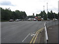
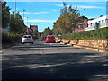
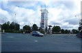
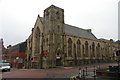

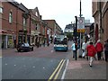
100 photos from this area
Area Information
Key information about the BL1 2QR including its size, population, and administrative classification.
- Area Type
- Postcode
- Area Size
- 9773 m²
- Population
- 2047
- Population Density
- 6466 people/km²
House Prices in BL1 2QR
45
Properties
£88,675
Average Sold Price
£19,760
Lowest Price
£220,000
Highest Price
Showing 45 properties
| Address | Type | Beds | Baths | Last Sale Price | Last Sale Date | |
|---|---|---|---|---|---|---|
| 56 Wentbridge Road, Bolton, BL1 2QR | Retail | 6 | 2 | £220,000 | Nov 2022 | |
| 21 Wentbridge Road, Bolton, BL1 2QR | Terraced | 2 | 1 | £79,369 | Mar 2020 | |
| 62 Wentbridge Road, Bolton, BL1 2QR | house | - | - | £66,000 | May 2017 | |
| 27 Wentbridge Road, Bolton, BL1 2QR | Terraced | 2 | 1 | £61,000 | Dec 2015 | |
| 6 Wentbridge Road, Bolton, BL1 2QR | house | 2 | - | £67,000 | Oct 2015 | |
| 58 Wentbridge Road, Bolton, BL1 2QR | house | - | - | £150,000 | Nov 2005 | |
| 25 Wentbridge Road, Bolton, BL1 2QR | Terraced | - | - | £74,950 | Oct 2005 | |
| 74 Wentbridge Road, Bolton, BL1 2QR | house | - | - | £19,760 | Apr 2003 | |
| 84 Wentbridge Road, Bolton, BL1 2QR | house | - | - | £60,000 | Oct 2000 | |
| 52 Wentbridge Road, Bolton, BL1 2QR | Bungalow | - | - | - | - |
Page 1 of 5
Energy Efficiency in BL1 2QR
Amenities
Schools
| Rank | School | Type | Entry gender | Ages |
|---|
Explore more schools in this area
Go to Schools tabDemographics
Household Size
One person
most common
Accommodation Type
Houses
most common
Tenure
22
majority
Ethnic Group
White
most common
Religion
N/A
most common
Household Composition
N/A
most common
Age
47
median
Adults (30-64 years)
most common
Household Deprivation
N/A
with no deprivation
NS-SEC
11
in Lower managerial occupations
Explore more demographic insights in this area
Go to Demographics tabPlanning
Planning Constraints
- Flood RiskPremium
- Ramsar Wetland SitesPremium
- Area of Outstanding Natural BeautyPremium
- Protected Nature ReservePremium
- Protected WoodlandPremium