Area Overview for BL1 2AA
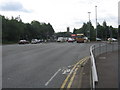
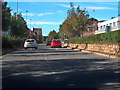
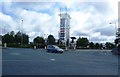
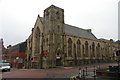
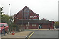
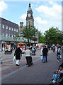
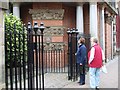
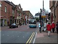
Photos of BL1 2AA


Area Information
BL1 2AA is a compact residential postcode in Bolton, England, covering just 1.2 hectares and home to 1,227 residents. With a population density of 100,987 people per square kilometre, this is a densely populated area, reflecting its small footprint. The community is centred around Queen’s Park, a historic Victorian park established in 1866, which remains a focal point for leisure and green space. The area’s proximity to the park, combined with its proximity to rail and metro links, makes it a practical choice for commuters. Daily life here is shaped by the park’s legacy, with its sloping grounds and River Croal running through its lower areas. While the population is small, the area’s density means a tight-knit community, though the 10% home ownership rate suggests many residents are renters. The mix of retail, transport, and green space offers a balance of convenience and tranquillity, albeit in a highly concentrated setting.
- Area Type
- Postcode
- Area Size
- 1.2 hectares
- Population
- Not available
- Population Density
- Not available
The property market in BL1 2AA is dominated by rental flats, with only 10% of residents owning their homes. This suggests a market where private landlords and housing associations hold significant influence, rather than individual homeowners. The prevalence of flats indicates a need for high-density housing, which aligns with the area’s small size and high population density. For buyers, this means limited opportunities for owner-occupied properties, and those seeking to purchase may need to look beyond the immediate postcode to find available homes. The compact nature of BL1 2AA also means that property choices are constrained, with little scope for expansion or development. Prospective buyers should consider the area’s rental-focused dynamics and the potential challenges of securing a purchase in such a densely populated, small postcode.
House Prices in BL1 2AA
No properties found in this postcode.
Energy Efficiency in BL1 2AA
The lifestyle in BL1 2AA is shaped by its proximity to Queen’s Park, a historic Victorian park featuring duck ponds, sunken gardens, and children’s play areas. This green space offers recreational opportunities and a connection to the area’s heritage. Nearby retail options include Morrisons and Aldi, providing essential shopping. The area’s rail and metro links ensure easy access to Bolton and surrounding towns, supporting both commuting and leisure travel. The combination of green space, retail, and transport infrastructure creates a balanced lifestyle, though the high population density may mean shared spaces and a need for community cooperation.
Amenities
Schools
The nearest school to BL1 2AA is A.CofE Project, though its specific type and Ofsted rating are not detailed in the data. The absence of other schools in the immediate vicinity suggests that families may need to look further afield for additional educational options. Given the area’s small size and high population density, the availability of a single school may impact the convenience for parents and students. The lack of detailed information on the school’s performance or facilities means that prospective residents should conduct further research or consult local education authorities for a comprehensive understanding of the options available.
| Rank | School | Type | Entry gender | Ages |
|---|
Explore more schools in this area
Go to Schools tabDemographics
The population of BL1 2AA has a median age of 47, with the majority of residents aged between 30 and 64. This suggests a mature, stable community with a focus on established households. Home ownership is low, with only 10% of residents owning their homes, indicating a predominantly rental market. The accommodation type is almost exclusively flats, reflecting the area’s compact nature and the need for space-efficient housing. The predominant ethnic group is White, though specific diversity statistics are not provided. The age profile implies a population that is likely to have strong ties to local institutions and services. The high population density, combined with the low home ownership rate, may influence the character of the area, with a greater emphasis on shared spaces and communal living.
Household Size
Accommodation Type
Tenure
Ethnic Group
Religion
Household Composition
Age
Household Deprivation
NS-SEC
Explore more demographic insights in this area
Go to Demographics tabPlanning
Planning Constraints
- Flood RiskPremium
- Ramsar Wetland SitesPremium
- Area of Outstanding Natural BeautyPremium
- Protected Nature ReservePremium
- Protected WoodlandPremium