Area Overview for BL1 1SA
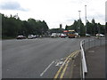
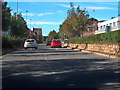
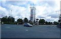
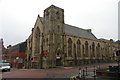
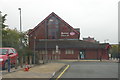
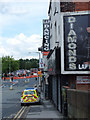
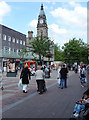
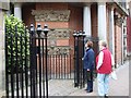
Photos of BL1 1SA


Area Information
BL1 1SA is a small residential postcode in Bolton, Greater Manchester, home to 1,227 people. It is a compact area where daily life is shaped by proximity to Queen’s Park, a historic Victorian park established in 1866. The park, covering 22 acres, offers a mix of open spaces, duck ponds, and listed statues, reflecting the area’s industrial heritage and green legacy. Residents benefit from a mature community, with a median age of 47 and a population skewed toward adults aged 30–64. The area’s character is defined by its proximity to Bolton’s town centre, with nearby rail and metro links providing easy access to regional hubs. While the postcode is small, it is well-connected to retail, transport, and recreational spaces. Living here means navigating a mix of practicality and history, with a focus on accessible amenities and a relatively quiet, established residential vibe. The low flood risk and absence of environmental constraints make it a stable choice, though safety considerations remain critical.
- Area Type
- Postcode
- Area Size
- Not available
- Population
- Not available
- Population Density
- Not available
BL1 1SA is a small area with limited housing stock, dominated by flats rather than detached or semi-detached homes. With only 10% of residents owning their homes, the market is likely to be rental-focused, which may limit opportunities for buyers seeking owner-occupied properties. The prevalence of flats suggests a need for proximity to public transport and amenities, as these units are often more practical in compact urban settings. Given the area’s size, property choices are constrained, and buyers may need to consider nearby postcode areas for more options. The low home ownership rate also indicates that landlords may dominate the market, potentially affecting availability and competition for properties. For those considering purchase, the small footprint of BL1 1SA means that nearby areas—such as Bolton’s broader town centre—could offer more variety, though they may come with higher costs or different community dynamics.
House Prices in BL1 1SA
No properties found in this postcode.
Energy Efficiency in BL1 1SA
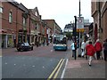
Living in BL1 1SA offers access to a mix of retail, transport, and green spaces. The nearby retail options include Morrisons Bolton, Aldi Great, and Sainsburys Bolton, providing convenience for groceries and daily essentials. Public transport is robust, with five rail stations and three metro stops within practical reach, connecting residents to Bolton’s town centre and beyond. The area’s most notable feature is Queen’s Park, a Victorian park with duck ponds, a children’s play area, and listed statues, offering a space for recreation and relaxation. The park’s historical significance, including its role in the 1860s cotton famine, adds cultural depth to the area. The proximity to transport hubs and retail makes daily life efficient, while the park provides a contrast to the urban environment. However, the limited range of amenities means residents may need to travel slightly further for specialist services or entertainment.
Amenities
Schools
The only school listed near BL1 1SA is A.CofE Project, categorised as ‘other’ in the data. No Ofsted rating is provided, so its performance remains unspecified. The absence of other schools in the immediate vicinity suggests limited educational options for families, which may influence decisions about relocating to the area. A.CofE Project’s type is not defined as primary, secondary, or sixth-form college, leaving uncertainty about its role in the local education system. For parents seeking a range of school types—such as state, private, or specialist institutions—the area may require a broader search beyond BL1 1SA. The single school listed does not provide clarity on its capacity or curriculum, meaning prospective residents would need to investigate further to assess its suitability for their children’s needs.
| Rank | School | Type | Entry gender | Ages |
|---|
Explore more schools in this area
Go to Schools tabDemographics
BL1 1SA has a median age of 47, with the majority of residents falling into the 30–64 age range. This suggests a mature, settled community, likely with strong family ties and a focus on stability. Home ownership is low at 10%, indicating that most residents are likely to rent, which could reflect the area’s historical development as a working-class residential zone. The accommodation type is predominantly flats, a common feature in older urban areas. The predominant ethnic group is White, though no specific data on diversity or deprivation levels is provided. This demographic profile implies a community with established routines and a reliance on local services. The age distribution suggests a population with a mix of active professionals and retirees, though the absence of younger families may influence local amenities and school demand. The low home ownership rate also points to a rental market, which could affect property values and long-term investment potential.
Household Size
Accommodation Type
Tenure
Ethnic Group
Religion
Household Composition
Age
Household Deprivation
NS-SEC
Explore more demographic insights in this area
Go to Demographics tabPlanning
Planning Constraints
- Flood RiskPremium
- Ramsar Wetland SitesPremium
- Area of Outstanding Natural BeautyPremium
- Protected Nature ReservePremium
- Protected WoodlandPremium