Area Overview for BL1 1RB
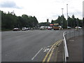
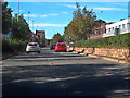
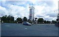
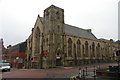
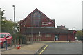
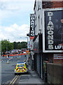
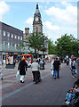
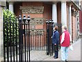
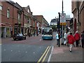
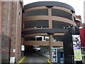
Photos of BL1 1RB


Area Information
BL1 1RB is a small residential postcode area in Bolton, Greater Manchester, home to 1,227 people. It sits within a compact cluster of properties, offering a quiet, low-density living environment. The area is closely linked to Queen’s Park, a historic Victorian park established in 1866, which provides a green space for residents. The park’s 22-acre layout includes duck ponds, sunken gardens, and a children’s play area, making it a focal point for local leisure. Living here means being part of a community with a median age of 47, where most residents are adults aged 30–64. The area’s proximity to rail and metro stations, including Bolton Railway Station and Bury Metro stops, ensures easy access to nearby towns and cities. While the population is small, the area’s mix of retail options, such as Morrisons Bolton and Aldi Halliwell, supports daily needs. BL1 1RB is a place where historical heritage meets practical modern living, with a focus on connectivity and community.
- Area Type
- Postcode
- Area Size
- Not available
- Population
- Not available
- Population Density
- Not available
BL1 1RB’s property market is characterised by a 10% home ownership rate, meaning the vast majority of properties are rented rather than owner-occupied. The accommodation type is predominantly flats, which suggests a housing stock designed for smaller households or those prioritising rental affordability. This dynamic positions the area as a rental-focused zone, with limited opportunities for long-term property investment. The small population and compact size of BL1 1RB mean the housing supply is constrained, potentially limiting options for buyers. For those seeking to purchase, the area’s flat-dominated market may offer fewer choices compared to regions with a higher proportion of owner-occupied homes. However, the proximity to transport links and amenities like Queen’s Park could offset the lack of property diversity. Buyers should consider the area’s limited scale and the potential for higher competition in the rental market when evaluating BL1 1RB as a viable option.
House Prices in BL1 1RB
No properties found in this postcode.
Energy Efficiency in BL1 1RB
Residents of BL1 1RB have access to a range of amenities within walking or short driving distance. Retail options include Morrisons Bolton, Aldi Halliwell, and Aldi Great, providing grocery and household essentials. Transport links are extensive, with five rail stations and five metro stops offering connections to Bolton, Bury, and Manchester. Queen’s Park, a historic Victorian park, is a key leisure asset, featuring duck ponds, sunken gardens, and a children’s play area. The park’s Grade II listed statues and heritage walkways add cultural value to daily life. While the area’s small size means amenities are concentrated, the mix of retail, transport, and green space supports a practical lifestyle. The proximity to Queen’s Park also offers opportunities for outdoor activities, from picnics to fitness walks. For those prioritising convenience, BL1 1RB’s amenities are sufficient for basic needs but may require a trip to nearby towns for more specialised services.
Amenities
Schools
The only named school near BL1 1RB is A.CofE Project, which is categorised as an ‘other’ type. No Ofsted rating is provided in the data, so its performance remains unspecified. The limited number of schools in the area suggests that families may need to look beyond BL1 1RB for a broader selection of educational institutions. Given the area’s small size and population, it is unlikely to host multiple schools. For parents prioritising school proximity, this could mean a commute to nearby towns such as Bolton or Bury, where more schools are available. The absence of detailed data on school quality or capacity means prospective residents should conduct further research into local education options. The single school listed in BL1 1RB may not meet the needs of all families, particularly those requiring a range of educational choices.
| Rank | School | Type | Entry gender | Ages |
|---|
Explore more schools in this area
Go to Schools tabDemographics
BL1 1RB has a median age of 47, with the majority of residents aged 30–64. This suggests a mature, working-age population, likely with established careers and families. Home ownership is low, at just 10%, indicating that most households are renters rather than property owners. The primary accommodation type is flats, reflecting a housing stock suited to smaller households or those seeking rental flexibility. The predominant ethnic group is White, though specific diversity data is not provided. The low home ownership rate may influence the area’s social dynamics, with a higher proportion of transient residents compared to owner-occupied neighbourhoods. For those considering BL1 1RB, the demographic profile highlights a stable, adult-oriented community with limited intergenerational diversity. The absence of detailed deprivation data means the area’s quality of life remains unquantified, but the presence of amenities and transport links suggests a functional, if modest, living environment.
Household Size
Accommodation Type
Tenure
Ethnic Group
Religion
Household Composition
Age
Household Deprivation
NS-SEC
Explore more demographic insights in this area
Go to Demographics tabPlanning
Planning Constraints
- Flood RiskPremium
- Ramsar Wetland SitesPremium
- Area of Outstanding Natural BeautyPremium
- Protected Nature ReservePremium
- Protected WoodlandPremium