Area Overview for BL1 1QP
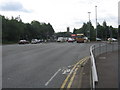
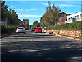
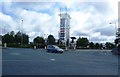
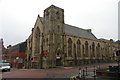
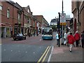
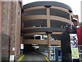
Photos of BL1 1QP


Area Information
BL1 1QP is a small residential postcode in Bolton, Greater Manchester, with a population of 2064. It is part of a compact cluster of homes, many of which are traditional houses. The area’s character is shaped by its proximity to Queen’s Park, a Victorian public park established in 1866. This heritage site, covering 22 acres, features historic statues, duck ponds, and a sunken garden, offering residents a mix of green space and cultural history. The park’s location near Chorley New Road and its connection to Bolton’s industrial past provide a tangible link to the region’s development. Daily life here is defined by proximity to local amenities, including retail stores like Morrisons and Sainsburys, as well as rail and metro links to Bolton and surrounding areas. While the area’s small size means a tight-knit community, it also requires residents to travel slightly for specialist services. The blend of historical sites, practical infrastructure, and accessible transport makes BL1 1QP a niche choice for those seeking a quiet, rooted environment with a touch of heritage.
- Area Type
- Postcode
- Area Size
- Not available
- Population
- 2064
- Population Density
- 2436 people/km²
BL1 1QP is primarily a housing area with a focus on traditional homes, though home ownership is limited to 33% of residents. This suggests a rental market dominates, with many properties occupied by tenants rather than owner-occupiers. The presence of houses, rather than flats or apartments, indicates a preference for larger, more private living spaces, which may appeal to families or individuals seeking space. However, the small size of the postcode means the housing stock is limited, and buyers may need to look beyond the immediate area for a wider selection. The low home ownership rate could also mean competitive rental demand, particularly for properties in good condition. For those considering purchase, the area’s compact nature means proximity to amenities is a key advantage, though property values may be influenced by the broader Bolton market rather than local specifics.
House Prices in BL1 1QP
No properties found in this postcode.
Energy Efficiency in BL1 1QP
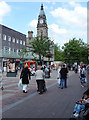
BL1 1QP’s lifestyle is defined by its proximity to Queen’s Park, a historic Victorian space with duck ponds, tennis courts, and a sunken garden. This park serves as a central leisure hub, offering walking routes, family activities, and a connection to Bolton’s heritage. Nearby, residents can access major retail outlets like Morrisons, Iceland, and Sainsburys, ensuring daily shopping needs are met. The area’s rail and metro links provide easy access to Bolton’s cultural and commercial centres, while the M62 motorway offers regional connectivity. The mix of green space and practical amenities creates a convenient, low-key lifestyle. However, the lack of specialist services or entertainment venues within the postcode means residents may need to travel for more niche pursuits. Overall, BL1 1QP offers a quiet, functional environment with a focus on accessibility and historical charm.
Amenities
Schools
The schools nearest to BL1 1QP include the Re-Integration Unit, Short Term Reintergration PRU, and Bolton Community, all categorised as 'other' in the data. These institutions are not traditional primary or secondary schools but may serve specific educational needs, such as alternative provision or specialist support. The absence of standard school types like academies or state-funded schools suggests the area may not be ideal for families seeking a comprehensive education system for children. Residents requiring mainstream schooling may need to look further afield, potentially increasing commuting times. The mix of school types reflects a focus on niche or temporary educational settings, which could be relevant for households with particular requirements. However, the lack of detailed Ofsted ratings or performance metrics means the quality of education here remains unclear.
| Rank | School | Type | Entry gender | Ages |
|---|
Explore more schools in this area
Go to Schools tabDemographics
The population of BL1 1QP is predominantly adults aged 30–64, with a median age of 47. This suggests a mature community, likely with established families and professionals. Home ownership in the area is relatively low at 33%, indicating that a significant portion of residents rent their homes. The primary accommodation type is houses, which may reflect a preference for larger properties in a residential setting. The predominant ethnic group is White, though specific data on diversity or deprivation is not provided. The age profile and housing stock suggest a stable, long-term resident base rather than a transient population. For buyers, this demographic profile implies a community focused on practical living rather than high-end property speculation. The lack of detailed diversity metrics means broader social dynamics remain unexplored, but the data confirms a straightforward, family-oriented demographic.
Household Size
Accommodation Type
Tenure
Ethnic Group
Religion
Household Composition
Age
Household Deprivation
NS-SEC
Explore more demographic insights in this area
Go to Demographics tabPlanning
Planning Constraints
- Flood RiskPremium
- Ramsar Wetland SitesPremium
- Area of Outstanding Natural BeautyPremium
- Protected Nature ReservePremium
- Protected WoodlandPremium