Area Overview for BL1 1PH
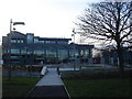
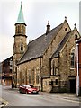
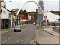
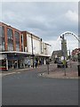
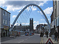
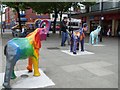
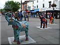
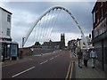
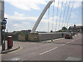
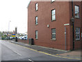
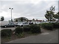
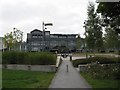
Photos of BL1 1PH
Area Information
BL1 1PH is a small residential postcode area in Bolton, Greater Manchester, home to 2,090 people. It sits within a compact cluster of housing, with a character defined by its proximity to Queen’s Park, a historic Victorian space spanning 22 acres. This area is distinct for its mix of practical living and heritage, with the park offering recreational spaces like duck ponds, sunken gardens, and tennis courts. The community is largely composed of adults aged 30–64, reflecting a mature demographic. Daily life here is shaped by proximity to local amenities, including five rail stations such as Bolton and Hall i’ th’ Wood, and retail hubs like Morrisons and Sainsburys. While the area is small, it connects to broader networks via metro stops at Radcliffe and Bury. The low crime risk score of 97/100 underscores a safe environment, and digital connectivity scores of 90 (broadband) and 85 (mobile) ensure modern convenience. BL1 1PH balances practicality with historical charm, making it a viable choice for those seeking a quiet, well-connected residential setting.
- Area Type
- Postcode
- Area Size
- Not available
- Population
- 2090
- Population Density
- 2396 people/km²
BL1 1PH is a rental-dominated area, with only 15% of residents owning their homes. The housing stock consists almost entirely of flats, reflecting a compact, likely purpose-built residential development. This suggests limited scope for owner-occupied properties, which may appeal to tenants seeking stable, low-maintenance housing. The small size of the area means buyers must look beyond BL1 1PH itself for larger properties, though nearby zones may offer more variety. The flat-based market could be advantageous for those prioritising convenience over space, with proximity to amenities like Queen’s Park and rail stations. However, the low home ownership rate may indicate a lack of long-term investment in the area, potentially affecting property appreciation. For buyers, this postcode is better suited to renters or those seeking secondary residences rather than primary homes.
House Prices in BL1 1PH
No properties found in this postcode.
Energy Efficiency in BL1 1PH
Living in BL1 1PH offers a blend of practicality and green space. Queen’s Park, a Victorian park with duck ponds, sunken gardens, and a children’s play area, is a key local attraction, providing recreational opportunities for residents. Nearby retail options include Morrisons, Iceland, and Sainsburys, ensuring everyday shopping needs are met. The five rail stations and metro stops at Radcliffe and Bury connect residents to Bolton and beyond, facilitating commuting or leisure travel. The area’s compact nature means amenities are within walking or short driving distance, enhancing convenience. The park’s historical features, such as Grade II listed statues and a cenotaph, add cultural depth to daily life. This postcode is ideal for those seeking a balance between urban accessibility and natural spaces, with a focus on community-oriented living.
Amenities
Schools
BL1 1PH is served by a mix of educational institutions, including St Peter and St Paul RC Primary School, which holds a good Ofsted rating. This primary school provides a solid foundation for younger children, while Bolton Sixth Form College caters to older students pursuing further education. Additional facilities include The Young Mums Unit, which offers support for specific community needs, and Premier Training, likely focused on vocational or adult education. The presence of both primary and sixth-form institutions suggests a comprehensive educational ecosystem for families. However, the absence of secondary schools in the immediate area may require students to commute to nearby towns. The good Ofsted rating at the primary school is a positive indicator for families prioritising quality education, though further research into secondary options is advisable.
| Rank | School | Type | Entry gender | Ages |
|---|
Explore more schools in this area
Go to Schools tabDemographics
The population of BL1 1PH is 2,090, with a median age of 47 and the most common age range being adults aged 30–64. Only 15% of residents own their homes, indicating a predominantly rental market. The accommodation type is primarily flats, reflecting a compact housing stock. The predominant ethnic group is White, though specific diversity data is not provided. The age profile suggests a community of middle-aged individuals, likely with established careers and families. This demographic may influence local services and amenities, with schools and retail tailored to adult needs. The low home ownership rate could indicate a transient population or a focus on rental properties, which may affect property values and investment potential. The area’s maturity is evident in its infrastructure, including nearby schools and transport links, catering to a settled but not overly youthful population.
Household Size
Accommodation Type
Tenure
Ethnic Group
Religion
Household Composition
Age
Household Deprivation
NS-SEC
Explore more demographic insights in this area
Go to Demographics tabPlanning
Planning Constraints
- Flood RiskPremium
- Ramsar Wetland SitesPremium
- Area of Outstanding Natural BeautyPremium
- Protected Nature ReservePremium
- Protected WoodlandPremium