Area Overview for BL1 1LE
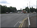
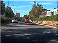
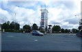
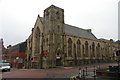
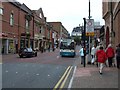
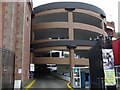
Photos of BL1 1LE


Area Information
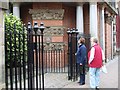
Living in BL1 1LE means residing within a specific residential cluster defined by postcode BL1 1LE in England. This postcode covers a small area of 465 square metres and serves a population of 2,064 people. The density here is extremely high, recorded at 444,252 people per square kilometre, which characterises the urban nature of this location. While the immediate footprint of the postcode is compact, the surrounding Bolton context provides the backdrop for daily life. The area is situated near Queen's Park, a historic Victorian public park established in 1866. This 8.9-hectare green space features the River Croal and offers access to tennis courts, duck ponds, and a Grade II listed entrance lodge now operating as a cafe. Residents benefit from proximity to this heritage site, which stands on sloping ground north-west of Bolton town centre. The location provided a mix of Victorian planting and walkways, making it a central feature for leisure. Living in BL1 1LE offers direct access to significant historical landmarks while maintaining a residential focus. The combination of urban density and nearby green infrastructure defines the character of homes in this postcode.
- Area Type
- Postcode
- Area Size
- 465 m²
- Population
- 2064
- Population Density
- 2436 people/km²
The housing market in BL1 1LE is characterised by a specific mix of tenure and housing stock. Houses represent the predominant accommodation type within the postcode area. Home ownership stands at 33 per cent, meaning roughly one-third of residents own their property outright or have a mortgage. This figure implies that a larger proportion of the population likely rents. For buyers searching for homes in BL1 1LE, the scarcity of the postcode footprint means viewing options may require looking at the immediate wider Bolton vicinity rather than relying solely on the specific 465 metres cover. The lack of data on price trends means you cannot assess capital growth based on this specific cluster alone. However, the 33 per cent ownership rate is a concrete indicator of the local economy. If you are looking to purchase, expect a market where investment opportunities exist but competition may be high due to the small supply. The focus on Houses suggests you will find more traditional layouts compared to apartment complexes. This tenure split is typical of inner-city Bolton residential zones where rent remains a viable option for many.
House Prices in BL1 1LE
No properties found in this postcode.
Energy Efficiency in BL1 1LE
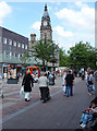
Your lifestyle in BL1 1LE benefits from immediate access to practical amenities and historic leisure options. Five retail outlets are within practical reach, including Morisons Bolton, Iceland Bolton, and Aldi Great for your daily grocery needs. Transport links include five rail and five metro connections to places like Radcliffe and Bury Bolton Street. These facilities ensure you can travel easily without relying solely on a car. Beyond shopping, you have access to Queen's Park, a 22-acre Victorian heritage site. This park features the River Croal, a bandstand, and Grade II listed statues of Benjamin Disraeli and John Fielding. The area provides tennis courts, children's play areas, and a sunken garden for recreational use. Historical elements like the cenotaph and the Chadwick Museum site add cultural depth to the local environment. Day-to-day life involves a balance of urban convenience and green space. The presence of listed cafes and walkways enhances the aesthetic quality of the streets. You can walk to major retail chains and public transport hubs, making life convenient for commuters.
Amenities
Schools
There are three institutions listed as nearby schools for residents of BL1 1LE, all categorised under the type 'other'. You will find the Re-Integration Unit, the Short Term Reintegration PRU, and Bolton Community in the vicinity of the postcode. These facilities serve the educational and support needs of the local population. None of the listed schools carry a standard primary or secondary designation within the provided data, which indicates a focus on specific specialized education or temporary provision rather than standard age-based schooling. For families living in BL1 1LE, the presence of these institutions suggests a localized approach to special education needs or short-term placement. The mix of school types means that standard primary school options are not detailed in the current information, so you must consider transport to larger specialist sites or nearby standard schools outside the immediate list. Hall i' th' Wood and Bolton town centre likely host broader educational demands alongside the specialized facilities. Researching the catchment areas for the Bolton Community school would be essential for prospective parents living in this area.
| Rank | School | Type | Entry gender | Ages |
|---|
Explore more schools in this area
Go to Schools tabDemographics
The community in BL1 1LE is defined by a mature population profile. The median age is 47 years, with the adult age range of 30 to 64 years being the most common group. This age structure suggests a neighbourhood dominated by established residents rather than young families or students. Over 33 per cent of households own their homes, indicating a significant level of stability among the occupants. Currently, Houses constitute the primary type of accommodation in the area. The predominant ethnic group is White, reflecting the demographic composition of the wider Bolton region. These figures point to an area likely favoured by those seeking established neighbourhoods with a clear residential focus. The demographic data supports a picture of residents who have settled in for the long term. When considering who lives here, you find a mostly owner-occupied community with a focus on family-sized or larger housing types. The population density and age profile suggest a stable community dynamic. Understanding these numbers helps clarify the typical resident of BL1 1LE and the social fabric of the locality.
Household Size
Accommodation Type
Tenure
Ethnic Group
Religion
Household Composition
Age
Household Deprivation
NS-SEC
Explore more demographic insights in this area
Go to Demographics tabPlanning
Planning Constraints
- Flood RiskPremium
- Ramsar Wetland SitesPremium
- Area of Outstanding Natural BeautyPremium
- Protected Nature ReservePremium
- Protected WoodlandPremium