Area Overview for BL1 1BN
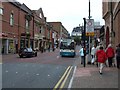
Photos of BL1 1BN


Area Information
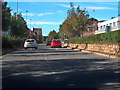
BL1 1BN is a compact postcode covering a small residential cluster within the broader context of Bolton. This specific area encompasses just 1478 square metres, housing a population of 1227 people. The density here is high, with 830,424 people per square kilometre recorded in the dataset, though this figure represents the specific mathematical density of the provided footprint. Life in this location is defined by its residential nature, situated in a region that includes the historic Queen's Park. This Victorian public park, established under the Bolton Improvement Act 1864, lies on sloping ground north-west of town centre with the River Croal running through its lower area. The area sits near Chorley New Road and serves as part of the larger Bolton municipality in Greater Manchester. Residents here experience living in BL1 1BN as a private enclave within a larger urban fabric. The area's small physical size concentrates population quickly, creating a contained environment. You will find homes clustered closely together, reflecting the modest land area assigned to this postcode. Understanding this density helps you visualise the immediate surroundings of your potential property. The postcode represents a precise geographic point rather than a sprawling district, offering a focused slice of life in North West England.
- Area Type
- Postcode
- Area Size
- 1478 m²
- Population
- Not available
- Population Density
- Not available
The property market in BL1 1BN is characterised by a strong presence of rental accommodation. With home ownership at just 10 per cent, this area does not function as a traditional owner-occupation zone. Flats are the predominant accommodation type, indicating that the housing stock consists primarily of apartments or self-contained units rather than detached houses or semi-detached rows. This structure is evident in the small residential cluster that defines BL1 1BN. The high rental share means you will encounter properties suited for tenants seeking flexibility or local professionals who do not own. Anyone looking at homes in BL1 1BN should expect to navigate the rental process, whether they are a landlord investing in investment property or a tenant searching for a lease. The low ownership rate suggests that sales of long-term freehold properties are rare events here. Instead, the market revolves around leasehold arrangements common with flats. This is a market driven by demand from the local adult population, many of whom fall within the 30 to 64 age range. You will not find a community of young families buying their first home in this specific postcode. The accommodation type dictates the lifestyle, favouring those who prefer low-maintenance living within a flat. Understanding that 90 per cent of residents likely rent helps you gauge the intended use and condition of the properties available.
House Prices in BL1 1BN
No properties found in this postcode.
Energy Efficiency in BL1 1BN
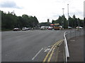
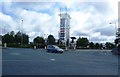
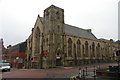
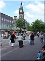
Living in BL1 1BN places you within practical reach of several key retail and transport hubs. Major retailers like Morrisons Bolton, Aldi Halliwell, and Iceland Bolton are among the nearby amenities listed. These supermarkets are within sprinting distance for your weekly grocery runs. Transport links are equally developed, with five nearby options including Bolton Railway Station, Hall i' th' Wood Railway Station, and Moses Gate Railway Station. These rail options allow you to commute across Greater Manchester efficiently. Metro services connect you to Radcliffe, Bury, and Bolton Street, expanding your reach beyond the local postcode. The area is not isolated; it sits near the historic Queen's Park, a Victorian public park spanning 22 acres. This heritage site features flowerbeds, duck ponds, a sunken garden, tennis courts, and a bandstand. Created during the 1860s cotton famine, the park remains a cultural landmark with Grade II listed statues including those of Benjamin Disraeli and John Fielding. You can walk to enjoy these green spaces without needing a car. The proximity to these specific venues adds cultural depth to your daily routine. Shops and stations are strategically located to support the 1227 residents in the area. Daily life involves easy access to food, travel, and leisure facilities without travelling far.
Amenities
Schools
The educational landscape immediately surrounding BL1 1BN is limited compared to other residential areas. The nearest institution listed is A.CofE Project, identified as a school of the 'other' type. This designation means the school does not fall into the standard categories of maintained or academy primary or secondary establishments. For families considering living in BL1 1BN, the proximity to A.CofE Project offers an option for education. However, the sheer number of schools listed in this specific data scope is very small. There is no data on Ofsted ratings for this institution within the provided information. This lack of official grading means you cannot rely on test scores or inspection reports from this dataset alone. You must verify the current status of A.CofE Project through external channels before making decisions. The mix of school types indicates a need to look beyond the immediate postcode for comprehensive options. Living in BL1 1BN means your children may need a commute to find a full-range of educational providers. The presence of A.CofE Project is a genuine asset nearby, but its classifications require further investigation by parents seeking specific curricula or inspection grades.
| Rank | School | Type | Entry gender | Ages |
|---|
Explore more schools in this area
Go to Schools tabDemographics
The community in BL1 1BN reflects a mature demographic profile. The median age is 47 years, and Adults aged between 30 and 64 years represent the most common age range. This indicates a population drawn from prime working life through to retirement, rather than families with young children. Home ownership stands at a low 10 per cent, meaning the vast majority of residents likely rent their accommodation. Flats dominate the local housing stock, aligning with the percentage of owner-occupation. You will encounter a neighbourhood where rental properties are the norm. The predominant ethnic group is White, shaping the cultural character of the local community. With a median age of 47, you are looking at a neighbourhood where stability often precedes high turnover rates. The fact that only 10 per cent of households own their homes suggests a significant reliance on the private rental sector. This dynamic is typical of smaller clusters within larger urban zones where housing supply is limited. For anyone considering living in BL1 1BN, the age profile suggests a quieter, perhaps less youthful atmosphere compared to families' areas. The concentration of adult residents implies a demand for practical, functional housing solutions suitable for workers or retirees.
Household Size
Accommodation Type
Tenure
Ethnic Group
Religion
Household Composition
Age
Household Deprivation
NS-SEC
Explore more demographic insights in this area
Go to Demographics tabPlanning
Planning Constraints
- Flood RiskPremium
- Ramsar Wetland SitesPremium
- Area of Outstanding Natural BeautyPremium
- Protected Nature ReservePremium
- Protected WoodlandPremium