Area Overview for BL0 9PP
Photos of BL0 9PP
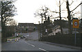
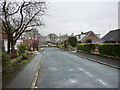
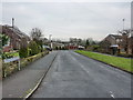
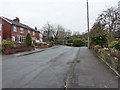
61 photos from this area
Area Information
Key information about the BL0 9PP including its size, population, and administrative classification.
- Area Type
- Postcode
- Area Size
- 2852 m²
- Population
- 1504
- Population Density
- 2954 people/km²
House Prices in BL0 9PP
20
Properties
£133,368
Average Sold Price
£72,500
Lowest Price
£234,000
Highest Price
Showing 20 properties
| Address | Type | Beds | Baths | Last Sale Price | Last Sale Date | |
|---|---|---|---|---|---|---|
| 30 Annie Street, Ramsbottom, BL0 9PP | Terraced | 2 | 1 | £195,500 | Jul 2024 | |
| 28 Annie Street, Ramsbottom, BL0 9PP | Terraced | 2 | 1 | £183,000 | Nov 2022 | |
| 9 Annie Street, Ramsbottom, BL0 9PP | house | - | - | £234,000 | Jan 2022 | |
| 10 Annie Street, Ramsbottom, BL0 9PP | Terraced | 2 | 1 | £155,000 | Aug 2019 | |
| 12 Annie Street, Ramsbottom, BL0 9PP | Terraced | 2 | - | £157,500 | Apr 2019 | |
| 26 Annie Street, Ramsbottom, BL0 9PP | Terraced | 2 | 1 | £150,000 | May 2018 | |
| 16 Annie Street, Ramsbottom, BL0 9PP | Terraced | 2 | - | £122,500 | Mar 2016 | |
| 7 Annie Street, Ramsbottom, BL0 9PP | Semi-detached | 3 | 1 | £130,000 | Feb 2014 | |
| 2 Annie Street, Ramsbottom, BL0 9PP | Terraced | 2 | 1 | £128,000 | Apr 2013 | |
| 22 Annie Street, Ramsbottom, BL0 9PP | house | 2 | 1 | £120,000 | May 2012 |
Page 1 of 2
Energy Efficiency in BL0 9PP
Amenities
Schools
| Rank | School | Type | Entry gender | Ages |
|---|
Explore more schools in this area
Go to Schools tabDemographics
Household Size
Two person
most common
Accommodation Type
Houses
most common
Tenure
86
majority
Ethnic Group
White
most common
Religion
N/A
most common
Household Composition
N/A
most common
Age
47
median
Adults (30-64 years)
most common
Household Deprivation
N/A
with no deprivation
NS-SEC
45
in Lower managerial occupations
Explore more demographic insights in this area
Go to Demographics tabPlanning
Planning Constraints
- Flood RiskPremium
- Ramsar Wetland SitesPremium
- Area of Outstanding Natural BeautyPremium
- Protected Nature ReservePremium
- Protected WoodlandPremium