Area Overview for BL0 9AU
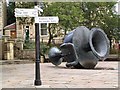
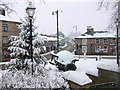
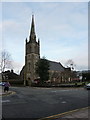
Photos of BL0 9AU
Area Information
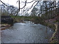
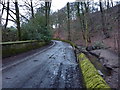
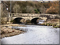
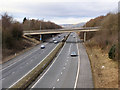
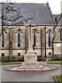
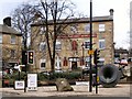
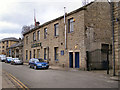
BL0 9AU is a small, densely populated residential cluster within the historic market town of Ramsbottom, part of Bury in Greater Manchester. Covering just 4.8 hectares, this postcode area is home to 1,835 residents, translating to a high population density of 1,551 people per square kilometre. The area sits on the River Irwell, nestled within the West Pennine Moors, a landscape shaped by industrial heritage and Victorian architecture. Ramsbottom itself is a town with roots in the 18th-century cotton industry, where figures like Robert Peel laid the groundwork for mill development. Today, the area retains a distinct character, with conservation areas and heritage sites such as Square Mill and St Paul’s Church (1849) adding to its historical charm. Living here means being part of a tight-knit community with easy access to nearby towns like Bury and Manchester, just 12 miles away. The proximity to rail and metro links, combined with a mix of retail and leisure options, makes BL0 9AU a practical choice for those seeking a balance between urban convenience and a touch of rural tranquillity.
- Area Type
- Postcode
- Area Size
- 4.8 hectares
- Population
- 1835
- Population Density
- 1551 people/km²
The property market in BL0 9AU is characterised by a high rate of home ownership (78%) and a predominance of houses over flats or other property types. This suggests a community of long-term residents who have invested in their homes, likely reflecting the area’s historical appeal as a residential hub. Given the small size of the postcode area—just 4.8 hectares—the housing stock is limited, which may mean buyers must consider nearby areas for more options. The focus on houses rather than apartments or terraced properties indicates a preference for family-friendly or more spacious living arrangements. For buyers, this could mean higher competition for available properties, but also the potential for stable property values. The absence of significant rental market data implies that the area is not a hotspot for short-term lets or investment properties, making it a more traditional, owner-occupied neighbourhood.
House Prices in BL0 9AU
No properties found in this postcode.
Energy Efficiency in BL0 9AU
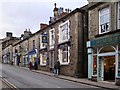
Living in BL0 9AU offers access to a range of amenities that cater to daily needs and leisure. The area’s retail scene includes major supermarkets like Tesco Ramsbottom and Morrisons Shuttleworth, alongside smaller shops, making errands convenient. Metro stations such as Ramsbottom and Bury Interchange provide easy access to public transport, while nearby rail stations connect to Manchester and other regional hubs. The area’s historical roots are reflected in its architecture, with Victorian buildings and conservation areas adding character. Though specific parks are not listed in the data, the proximity to the River Irwell and the West Pennine Moors suggests opportunities for outdoor activities. The presence of heritage sites like Square Mill and the East Lancashire Railway adds cultural value. For residents, this blend of practicality and historical interest creates a lifestyle that balances modern convenience with a connection to the past.
Amenities
Schools
| Rank | School | Type | Entry gender | Ages |
|---|
Explore more schools in this area
Go to Schools tabDemographics
The population of BL0 9AU has a median age of 47, with the majority of residents falling into the 30–64 age range. This suggests a community skewed towards middle-aged adults, likely including families and professionals. Home ownership is high, with 78% of residents living in owner-occupied properties, and the predominant accommodation type is houses. This contrasts with areas where flats or rented properties dominate, indicating a more settled, long-term resident base. The predominant ethnic group is White, though specific diversity statistics are not detailed in the data. The age profile and home ownership rate suggest a stable, established community with fewer transient residents. However, the high population density—1,551 people per square kilometre—raises questions about the availability of green spaces or private outdoor areas, which could impact quality of life for those prioritising open space.
Household Size
Accommodation Type
Tenure
Ethnic Group
Religion
Household Composition
Age
Household Deprivation
NS-SEC
Explore more demographic insights in this area
Go to Demographics tabPlanning
Planning Constraints
- Flood RiskPremium
- Ramsar Wetland SitesPremium
- Area of Outstanding Natural BeautyPremium
- Protected Nature ReservePremium
- Protected WoodlandPremium