Area Overview for BL0 0NW
Photos of BL0 0NW
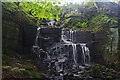
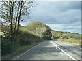
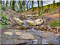
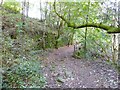
37 photos from this area
Area Information
Key information about the BL0 0NW including its size, population, and administrative classification.
- Area Type
- Postcode
- Area Size
- 2.5 hectares
- Population
- 1354
- Population Density
- 928 people/km²
House Prices in BL0 0NW
12
Properties
£142,900
Average Sold Price
£34,600
Lowest Price
£276,000
Highest Price
Showing 12 properties
| Address | Type | Beds | Baths | Last Sale Price | Last Sale Date | |
|---|---|---|---|---|---|---|
| 8 East View, Ramsbottom, Bury, BL0 0NW | Retail | 2 | 1 | £276,000 | Oct 2022 | |
| 9 EAST VIEW, Ramsbottom, Bury, BL0 0NW | Detached | - | - | £143,000 | Sep 2020 | |
| 2 East View, Ramsbottom, Bury, BL0 0NW | Terraced | 2 | 1 | £135,000 | Apr 2019 | |
| 7 East View, Ramsbottom, Bury, BL0 0NW | house | 2 | 1 | £165,000 | Nov 2014 | |
| 10 East View, Ramsbottom, Bury, BL0 0NW | house | - | - | £140,000 | May 2009 | |
| 5 East View, Ramsbottom, Bury, BL0 0NW | Terraced | 2 | 1 | £147,500 | Jun 2007 | |
| 11 East View, Ramsbottom, Bury, BL0 0NW | Terraced | - | - | £175,000 | Mar 2006 | |
| 3 East View, Ramsbottom, Bury, BL0 0NW | Terraced | - | - | £70,000 | Nov 2002 | |
| 4 East View, Ramsbottom, Bury, BL0 0NW | Terraced | - | - | £34,600 | Nov 1995 | |
| The Coach House, East View, Ramsbottom, Bury, BL0 0NW | Semi-detached | 3 | 1 | - | - |
Page 1 of 2
Energy Efficiency in BL0 0NW
Amenities
Schools
| Rank | School | Type | Entry gender | Ages |
|---|
Explore more schools in this area
Go to Schools tabDemographics
Household Size
Two person
most common
Accommodation Type
Houses
most common
Tenure
70
majority
Ethnic Group
White
most common
Religion
N/A
most common
Household Composition
N/A
most common
Age
47
median
Adults (30-64 years)
most common
Household Deprivation
N/A
with no deprivation
NS-SEC
38
in Lower managerial occupations
Explore more demographic insights in this area
Go to Demographics tabPlanning
Planning Constraints
- Flood RiskPremium
- Ramsar Wetland SitesPremium
- Area of Outstanding Natural BeautyPremium
- Protected Nature ReservePremium
- Protected WoodlandPremium