Area Overview for BL0 0FG
Photos of BL0 0FG


Area Information
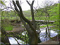
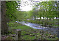
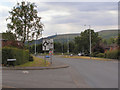
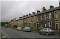
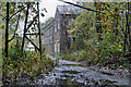
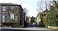
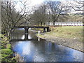
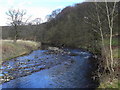
BL0 0FG is a small residential postcode in England, encompassing a compact cluster of homes with a population of 1,354 people. Its population density of 928 people per square kilometre suggests a tightly knit community, typical of rural or semi-rural areas. The area’s character is shaped by its post-industrial heritage, with roots in farming, mills, and quarrying that date back to the 16th century. Edenfield, the village associated with this postcode, lies near the River Irwell, within easy reach of Ramsbottom and Rawtenstall. Daily life here is defined by a mix of historic stone houses and post-war factory-brick housing, reflecting decades of industrial and residential evolution. The area’s proximity to key transport routes like the A56 and nearby railway stations makes it accessible to larger towns, while its low crime risk and minimal environmental constraints offer a sense of stability. For those seeking a quiet, low-density neighbourhood with a blend of historical and modern living, BL0 0FG provides a distinct alternative to urban centres.
- Area Type
- Postcode
- Area Size
- Not available
- Population
- 1354
- Population Density
- 928 people/km²
BL0 0FG is predominantly a home-ownership area, with 70% of residents owning their properties. The accommodation type is largely houses, which is typical for rural or semi-rural postcodes with limited high-density development. This suggests a market characterised by family homes rather than apartments or flats, making it more appealing to buyers seeking space and privacy. The small area’s housing stock is likely limited, given the low population and density, meaning properties may be in short supply for those looking to move into the immediate vicinity. For buyers, this could imply competitive pricing and a focus on existing homes rather than new builds. The area’s post-industrial heritage may also influence property values, with historic features like Pennine stone houses adding character but potentially limiting modernisation. Buyers should consider the small size of the area when exploring nearby options.
House Prices in BL0 0FG
No properties found in this postcode.
Energy Efficiency in BL0 0FG
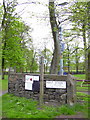
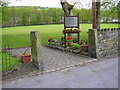
Living in BL0 0FG offers access to a range of nearby amenities, including five retail outlets such as Spar, Morrisons Shuttleworth, and Tesco Ramsbottom, ensuring daily shopping needs are met. The area’s proximity to railway stations like Entwistle, Bromley Cross, and Hall i’ th’ Wood connects residents to larger towns and transport hubs. While the data does not specify parks or leisure facilities, the village of Edenfield retains historic features like Edenfield Chapel and the Rostron Arms pub, contributing to a sense of local identity. The presence of a Community Centre and Cricket Club suggests opportunities for social engagement. The mix of retail, transport, and historical sites creates a lifestyle that balances rural tranquillity with practical connectivity for those who need it.
Amenities
Schools
The nearest school to BL0 0FG is Ramsbottom Stubbins Primary School, which is rated ‘good’ by Ofsted. This primary school serves the local community, providing education for younger children in the area. The absence of secondary schools or other educational institutions in the data means families may need to look beyond the immediate postcode for comprehensive schooling. However, the presence of a well-rated primary school is a positive factor for those prioritising early education. The school’s location in Ramsbottom, a nearby town, suggests it is accessible to residents of BL0 0FG via local roads or public transport. For families, this mix of local primary education and the need to travel for secondary schooling should be considered when evaluating the area’s suitability.
| Rank | School | Type | Entry gender | Ages |
|---|
Explore more schools in this area
Go to Schools tabDemographics
The median age in BL0 0FG is 47, with the majority of residents aged between 30 and 64 years. This suggests a mature, established community with a strong presence of middle-aged adults. Home ownership is high at 70%, indicating a stable residential base where most properties are owner-occupied rather than rented. The predominant accommodation type is houses, which aligns with the area’s rural character and lower population density. The predominant ethnic group is White, though specific data on diversity or deprivation is not provided. The age profile implies a community with a focus on long-term residency, potentially attracting families or professionals seeking a quieter lifestyle. The absence of detailed diversity metrics means the area’s social composition remains largely unexplored in this data, but the demographic stability suggests a cohesive, low-turnover environment.
Household Size
Accommodation Type
Tenure
Ethnic Group
Religion
Household Composition
Age
Household Deprivation
NS-SEC
Explore more demographic insights in this area
Go to Demographics tabPlanning
Planning Constraints
- Flood RiskPremium
- Ramsar Wetland SitesPremium
- Area of Outstanding Natural BeautyPremium
- Protected Nature ReservePremium
- Protected WoodlandPremium