Area Overview for Bigrigg
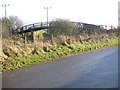
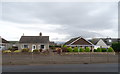
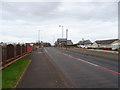
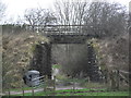
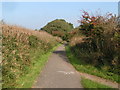
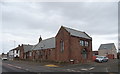
Photos of Bigrigg


Area Information
Bigrigg is a compact built-up area in England, covering 21.3 hectares. It is a small town or city, with a population profile skewed toward older residents, as the median age is 70. This suggests a community with a strong sense of continuity and established local networks. The area is well-served by nearby retail and transport infrastructure, including five retail outlets such as Spar and Co-op Cleator, and five railway stations, including St Bees and Nethertown. These amenities make daily life convenient, with easy access to shopping, travel, and connectivity. While the area’s size is modest, it offers a mix of practicality and accessibility, ideal for those prioritising proximity to essential services. The home ownership rate of 74% indicates a stable residential base, with many residents likely to have long-term ties to the area. For buyers, Bigrigg presents a blend of simplicity and functionality, suitable for those seeking a quieter, community-oriented lifestyle.
- Area Type
- Built Up Area 250
- Area Size
- 21.3 hectares
- Population
- Not available
- Population Density
- Not available
Living in Bigrigg provides access to a range of local amenities within practical reach. The area includes five retail outlets, such as Spar and Co-op Cleator, offering everyday shopping convenience. For those who enjoy rail travel, five stations—including St Bees Railway Station and Corkickle Railway Station—provide easy access to regional transport networks. While the data does not mention parks or leisure facilities, the presence of multiple retail and transport hubs suggests a functional, community-focused lifestyle. The proximity to shops and rail links makes daily errands and travel straightforward, supporting a practical, low-maintenance way of life.
Amenities
Schools
| Rank | A + A* % | School | Type | Entry gender | Ages |
|---|
Explore more schools in this area
Go to Schools tabDemographics
The population of Bigrigg has a median age of 70, reflecting a community dominated by older residents. The most common age range is listed as "Age: Total," which may indicate aggregated data rather than a specific demographic group. Home ownership is high, with 74% of households owning their homes, suggesting a stable and long-term resident base. However, details on household composition, accommodation types, and ethnic or religious diversity are not specified in the data. This lack of granularity means that while the area is clearly home to a significant proportion of older adults, the broader social fabric remains less defined. The absence of specific figures on deprivation or diversity means that quality of life factors beyond age and ownership are not quantified here.
Household Size
Accommodation Type
Tenure
Ethnic Group
Religion
Household Composition
Age
Household Deprivation
NS-SEC
Explore more demographic insights in this area
Go to Demographics tabPlanning
Planning Constraints
- Crime RiskLocked