Area Overview for Bidston and St. James Ward
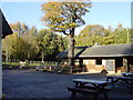
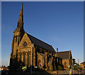
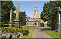
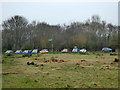
Photos of Bidston and St. James Ward


Area Information
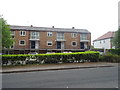
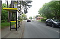
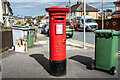
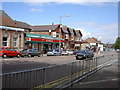
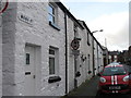
Bidston and St. James Ward occupies a distinctive position within the Metropolitan Borough of Wirral in North West England. This district covers an area of 7.0 km² and serves a population of 4,531 people. Living here means residing in a location that forms part of the Wirral peninsula, bordered historically by the River Mersey to the east and the River Dee to the west. The ward encompasses the village of Bidston, situated near the coordinates 53.407764, -3.054908, and has historically included areas such as Moreton, Saughall Massie, Claughton, and parts of Birkenhead. Daily life is defined by proximity to significant heritage sites, including Bidston Hill, which offers 100 acres of heathland, woodland, and a nature reserve. You will find the area anchored by Bidston Windmill, dating from circa 1800, and the Bidston Observatory. The landscape is further enriched by Bidston Hall, featuring a loggia and a medieval village layout comprising a church, farms, a green, and a manor house. Residents also have access to St Oswald's Church and Bidston Moss, a restored former landfill that now functions as a nature reserve. While the residential core features 16th to 18th century Grade II listed red sandstone farmhouses and cottages, the settlement retains an ancient parish recorded in the Domesday Book. Arriving by road likely involves navigating the A51 and mineral railway line that separates Bidston from Birkenhead.
- Area Type
- District Borough Unitary Ward
- Area Size
- 7.0 km²
- Population
- 4531
- Population Density
- 650 people/km²
Demographics
Understanding who lives in Bidston and St. James Ward requires looking at the specific age profile and household composition of this 7.0 km² area. The demographics indicate a median age of 70, suggesting the community skews significantly older than the national average. This high median age contextualises the finding that houses in Bidston and St. James Ward are not primarily family-sized properties. The ward reports a home ownership rate of 42%, which implies a substantial portion of the 4,531 residents are either renting or living with relatives rather than owning their property outright. Although the data does not specify a breakdown of household types or predominant ethnic groups, the overall population density stands at 650 people per km². This density figure reflects a compact settlement where services and neighbours are relatively close. The current demographic structure points to a settlement that may serve retirees or those seeking a quieter life near the coast. With such a high median age, local amenities and transport connectivity are likely tailored to an older adult demographic.
Household Size
Accommodation Type
Tenure
Ethnic Group
Religion
Household Composition
Age
Household Deprivation
NS-SEC
Explore more demographic insights in this area
Go to Demographics tabPlanning
Planning Constraints
- Flood RiskPremium
- Ramsar Wetland SitesPremium
- Area of Outstanding Natural BeautyPremium
- Protected Nature ReservePremium
- Protected WoodlandPremium
- Crime RiskPremium