Area Overview for Bewaldeth and Snittlegarth
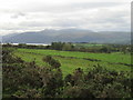
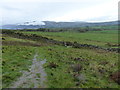
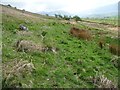
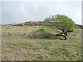
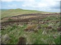
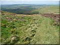
Photos of Bewaldeth and Snittlegarth
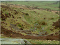
![Woodland on Binsey [2] in Bewaldeth and Snittlegarth](https://images.propbar.co.uk/images/geograph/39/52/3952248_120.jpg)
![Woodland on Binsey [3] in Bewaldeth and Snittlegarth](https://images.propbar.co.uk/images/geograph/39/52/3952256_120.jpg)
![Woodland on Binsey [4] in Bewaldeth and Snittlegarth](https://images.propbar.co.uk/images/geograph/39/52/3952289_120.jpg)
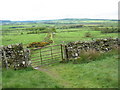
![Woodland on Binsey [1] in Bewaldeth and Snittlegarth](https://images.propbar.co.uk/images/geograph/39/52/3952227_120.jpg)
Area Information
Living in Bewaldeth and Snittlegarth offers a distinctly quiet life within a civil parish that defines the northern edge of the Lake District. This community sits behind Binsey Fell, approximately two miles north of Bassenthwaite Lake, placing residents close to the rugged fells while maintaining a separation from the most crowded tourist trap. The parish covers an area of 10.7 km², a manageable size that fosters a contained sense of place rather than sprawling urban anonymity. You will find yourself in a joint parish that historically formed part of Cumberland, with records from 1290 noting the manor of Bewaldeth and referencing Snittlegarth as a site of significant magnitude. Daily life here revolves around proximity to nature and a history deeply rooted in local gentry and agriculture. The area lies within the former Allerdale-below-Derwent ward and is located four miles south-south-west of Ireby. Historical accounts from 1848 highlight the presence of notable sites, including the property of E.H. Railton and the former residence of Lord Gillford. There are also listed buildings recorded in the National Heritage List for England, indicating a heritage-rich environment where architectural preservation is likely a priority. You are extending a legacy that dates back to Waltheof, lord of Allerdale, who granted the land in medieval times. Your days will likely be marked by rural silence rather than the rush of city transport, making this an idyllic spot for those seeking isolation without complete remoteness.
- Area Type
- Parish
- Area Size
- 10.7 km²
- Population
- Not available
- Population Density
- Not available
Demographics
The community profile in Bewaldeth and Snittlegarth points to a mature population rather than a bustling family hub. The median age of residents is 70, making this one of the oldest communities you will find in the national housing stock. While the data categorises the most common population simply as "Total", the high median age suggests that retirement living or older families form the demographic heart of the parish. Home ownership stands at a robust 75%, indicating that most occupants have established roots in the area and are not transient renters. Family formation appears to be a secondary characteristic of this village, given the age profile. The household composition data is recorded generally, but the age demographics suggest a structure suited to seniors rather than young couples or school-age groups. Regarding diversity, the predominant ethnic group, religion, and full accommodation breakdown are available in the records, though specific percentages for ethnicity are not detailed in the immediate summary. Despite this, the high level of home ownership often correlates with long-standing communities where residents know their neighbours. This stability creates a neighbourhood where decision-making may move at a slower pace, but where local loyalty is high. For you, this means a stable environment where property values are likely supported by owner-occupiers rather than speculative buyers. The low density and mature age profile mean you will encounter a quiet street scene rather than a busy marketplace.
Household Size
Accommodation Type
Tenure
Ethnic Group
Religion
Household Composition
Age
Household Deprivation
NS-SEC
Explore more demographic insights in this area
Go to Demographics tabPlanning
Planning Constraints
- Flood RiskPremium
- Ramsar Wetland SitesPremium
- Area of Outstanding Natural BeautyPremium
- Protected Nature ReservePremium
- Protected WoodlandPremium
- Crime RiskPremium