Area Overview for Betchton
Photos of Betchton
Area Information
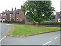
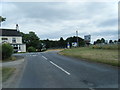
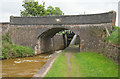
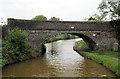
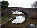
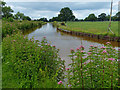
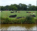
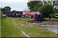
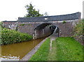
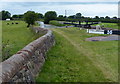
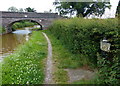
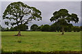
Betchton is a rural civil parish situated in Cheshire East, covering a total land area of 10.6 square kilometres. This parish encompasses several distinct locations, including Betchton Heath, Hassall Green, and Malkin's Bank. Historically, the area was once part of the Sandbach Ancient Parish before becoming a separate entity in 1866. Residents live near the coordinates 53.128532, -2.355646, which place it firmly within the North West England region under the postcode CW11 0GA. The community retains a strong connection to its past, having originally formed a township within Sandbach and later encompassing the Barony of Nantwich. Key landmarks define the local character, such as Betchton Hall, a structure rebuilt in the 18th century by Richard Jackson, and the historic Tin Tabernacle on New Inn Lane. The parish also features the Betchton Royalty, established in 1602, which granted perpetual common rights on Betchton Heath to freeholders. You might find a milestone at Brereton Green marking the original turnpike road that once connected Spann Smithy to Talk. Daily life here moves at a pace that reflects its history as a township in the Nantwich Hundred. The area was historically served by the A50 road, a route turnpiked around 1788, though modern transport links have evolved. Living in Betchton means experiencing a quiet existence where the legacy of the Audley family and the Gaskell family remains part of the local narrative. The parish boundaries include Hassall Green, an area known for its corrugated iron church from the early 1880s. Whether you are exploring the historic routes near Greenbank or simply enjoying the rural setting, the area offers a specific type of existence grounded in its heritage. The parish history, recorded in sources ranging from the Domesday Survey of 1086 to local genealogy records, shows a continuous thread of development that defines the current community for anyone considering homes in Betchton.
- Area Type
- Parish
- Area Size
- 10.6 km²
- Population
- Not available
- Population Density
- Not available
Demographics
The community in Betchton displays a clear demographic profile with a median age of 70 years. This figure indicates that the area has a population skewed towards older residents. The most common age range recorded for the total population supports the observation that this is an established community rather than a hub for young families or transient workers. With a median age of 70, the neighbourhood is primarily inhabited by seniors, which influences the demand for services like healthcare and leisure facilities suitable for older adults. There is no data provided regarding the specific predominant ethnic group, religion, or detailed household composition breakdowns, meaning you cannot make definitive claims about cultural diversity or family units beyond the age statistics. Despite the lack of granular data on these specific fronts, the age profile stands as a defining characteristic. The sheer proportion of older residents suggests a stable, settled population that has likely lived in the parish for many decades. When you look at living in Betchton, you are entering an environment where the demographic weight is heavily on the elderly, shaping the social atmosphere and local needs. The absence of younger age groups in standard profiles often correlates with lower noise levels and a different community dynamic compared to more mixed-age parishes.
Household Size
Accommodation Type
Tenure
Ethnic Group
Religion
Household Composition
Age
Household Deprivation
NS-SEC
Explore more demographic insights in this area
Go to Demographics tabPlanning
Planning Constraints
- Flood RiskLocked
- Ramsar Wetland SitesLocked
- Area of Outstanding Natural BeautyLocked
- Protected Nature ReserveLocked
- Protected WoodlandLocked
- Crime RiskLocked