Area Overview for Belle Vue Ward
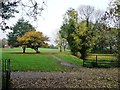
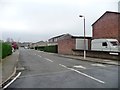
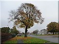
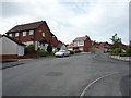
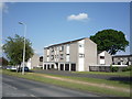
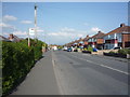
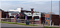
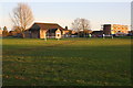
Photos of Belle Vue Ward
Area Information
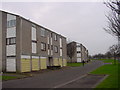
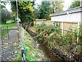
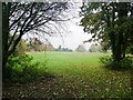
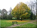
Living in Belle Vue Ward offers a defined slice of life within the City of Carlisle, Cumbria. This electoral ward spans a compact area of just 1.9 square kilometres, creating a close-knit environment that remains distinct within the CA2 7GG postcode region. Residents here experience daily life centred on a population of approximately 2,004 people. The location sits at specific coordinates of 54.892155, -2.96946, anchoring it firmly in North West England. You are looking at a community that balances residential space with significant local ownership, where more than two-thirds of households call this ground their own home. The ward represents a settled location where the number of residents is保持稳定, avoiding the rapid fluctuations often seen in emerging suburbs. When you consider homes in Belle Vue Ward, you are looking at an established part of Carlisle where the community density is moderate. The area is small enough to foster familiarity but large enough to separate from immediate urban congestion. This geography supports a lifestyle where neighbours know names and local infrastructure serves a consistent user base. The ward map from 2024 confirms these physical boundaries, giving buyers a clear understanding of what lies within the electoral district. You gain a clear picture of the neighbourhood limits and the scope of public services available to this specific group of residents. The compact size means that walking distances are likely a feature, connecting you to local hubs without requiring extensive travel. This structure defines the rhythm of daily life for the 2,004 individuals living within these boundaries.
- Area Type
- District Borough Unitary Ward
- Area Size
- 1.9 km²
- Population
- Not available
- Population Density
- Not available
Demographics
The community profile of Belle Vue Ward reveals a settled older population with strong ties to the locality. Data indicates a median age of 70 years, positioning this ward as one of the oldest in the city. You are looking at a demographic where the majority of residents fall into senior age brackets, which influences the types of amenities and social activities available. Home ownership stands as a defining characteristic, with 67 per cent of households owning their property outright or with a mortgage. This high rate suggests long-term stability and rootedness within the neighbourhood. Household composition reflects the older median age, indicating fewer young families or single-person households typical of younger districts. Accommodation types across the ward align with this established demographic, focusing on structures suited for mature homeowners. The area exhibits low levels of recent migration or transient living, reinforcing the sense of permanence. For those considering schools near Belle Vue Ward, you must acknowledge the age profile implies lower demand for primary education spots within the ward itself. However, the established nature of the residents often correlates with well-maintained local facilities. Ethnically and religiously, the resident base remains consistent with broader regional trends, though specific breakdowns for this ward were not detailed in the primary dataset. The 67 per cent ownership figure is the most significant statistic for understanding how people interact with this space. It points to a market driven by buying rather than renting, creating different dynamics for exchange rates and tenancy agreements. You are looking at a community where residents have likely lived in similar styles of housing for many years.
Household Size
Accommodation Type
Tenure
Ethnic Group
Religion
Household Composition
Age
Household Deprivation
NS-SEC
Explore more demographic insights in this area
Go to Demographics tabPlanning
Planning Constraints
- Flood RiskPremium
- Ramsar Wetland SitesPremium
- Area of Outstanding Natural BeautyPremium
- Protected Nature ReservePremium
- Protected WoodlandPremium
- Crime RiskPremium