Area Overview for Belah Ward
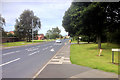
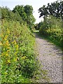
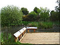
Photos of Belah Ward

Area Information
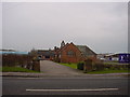
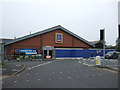
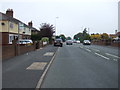
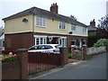
Living in Belah Ward offers a distinct experience within the City of Carlisle unitary authority in Cumbria. This electoral ward encompasses the suburb of Belah, positioned just a short distance from the city centre. The area spans 3.7 square kilometres, providing a defined local landscape for its residents. At its core, Belah Ward is a close-knit community with an approximate population of 1,668 people. Prospective homebuyers should note the unique character of this district, which sits at coordinates near postcode CA3 0EF. Daily life here revolves around a specific, established demographic rather than the fast-paced urban environment found further away from the city core. The ward represents a stable segment of the broader Carlisle region, offering a specific type of residential atmosphere. When considering homes in Belah Ward, you are entering an area with a clear historical and geographical identity. The suburb functions as a distinct pocket within the larger city structure, maintaining its own rhythm while benefiting from proximity to Carlisle's amenities. This balance makes it a specific choice for those seeking a defined locale without being isolated from urban services. The combination of its size and location defines the practical reality of living in this particular neighbourhood.
- Area Type
- District Borough Unitary Ward
- Area Size
- 3.7 km²
- Population
- Not available
- Population Density
- Not available
Demographics
The community in Belah Ward is defined by a pronounced age profile, with a median age of 70 years. This figure places the area firmly within a demographic often associated with retirement or late-stage life. The most common age range recorded is simply listed as total, but the median age indicates a head of household or resident base significantly older than the national average. Home ownership stands at a robust 77% across the ward, suggesting long-term stability and established residency rather than a transient population. The high rate of ownership implies that many households have resided in their properties for extended periods, creating a settled environment. Accommodation types and predominant ethnic groups are recorded but lack further descriptive breakdown in the current dataset, meaning the visual and cultural texture relies heavily on the established ownership figures. The household composition data is available in total form, reinforcing the idea that the area is not fluctuating rapidly with new families or students. For anyone interested in the quality of life here, the dominance of older, owner-occupied homes paints a clear picture. This demographic reality means the local shops and services are likely tailored to the needs of an older population. Living in Belah Ward currently means joining a community where the majority of residents have built a permanent life in this specific part of Cumbria.
Household Size
Accommodation Type
Tenure
Ethnic Group
Religion
Household Composition
Age
Household Deprivation
NS-SEC
Explore more demographic insights in this area
Go to Demographics tabPlanning
Planning Constraints
- Flood RiskPremium
- Ramsar Wetland SitesPremium
- Area of Outstanding Natural BeautyPremium
- Protected Nature ReservePremium
- Protected WoodlandPremium