Area Overview for BB9 9ST
Photos of BB9 9ST
Area Information
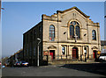
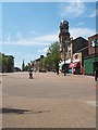
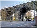
Living in BB9 9ST means being part of a small residential cluster in England’s North West, nestled in the Borough of Pendle, Lancashire. With a population of 1,892, this postcode reflects a compact community shaped by 19th-century industrial growth, driven by the Leeds-Liverpool Canal and the East Lancashire Railway. The area’s character blends historical roots with modern practicality, offering proximity to Nelson’s urban core, which centres on Manchester Road and Market Street. Residents benefit from nearby amenities, including retail outlets like Morrisons Nelson and rail connections to Nelson, Brierfield, and Colne stations. The postcode’s small scale means a tight-knit feel, though it sits within a larger town with a population of around 29,135. Daily life here is defined by accessible services, a mix of housing types, and a community profile skewed toward adults aged 30–64. For those seeking a balance between residential tranquillity and urban convenience, BB9 9ST offers a snapshot of a town that evolved from cotton-weaving roots into a contemporary commuter hub.
- Area Type
- Postcode
- Area Size
- Not available
- Population
- 1892
- Population Density
- 2746 people/km²
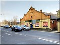
The property market in BB9 9ST is defined by a 43% home ownership rate, with houses forming the predominant accommodation type. This suggests a modest, owner-occupied market rather than a high proportion of rental properties, though the relatively low home ownership rate indicates a significant share of the housing stock is let. The area’s small size means the available properties are likely limited to individual homes rather than large developments. Given the historical context of Nelson as a 19th-century industrial town, the housing stock may include older, characterful properties, though specifics about their condition or demand are not provided. For buyers, this small postcode area offers a niche opportunity, with properties potentially serving both local residents and commuters relying on nearby rail links. The market’s scale and character suggest a focus on practical, family-oriented homes rather than luxury or investment properties.
House Prices in BB9 9ST
No properties found in this postcode.
Energy Efficiency in BB9 9ST
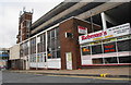
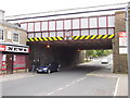
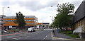
Residents of BB9 9ST have access to essential amenities within practical reach, including retail options like Spar Netherfield, Lidl Central, and Morrisons Nelson. These stores provide everyday shopping convenience, reducing the need for long trips to larger centres. The area’s rail stations, such as Nelson and Colne, offer direct links to broader transport networks, enhancing mobility for commuters. While the data does not specify parks or leisure facilities, the historical presence of weavers’ cottages and 19th-century commercial premises suggests a mix of urban and residential character. The combination of nearby shops, rail access, and proximity to Nelson’s town centre creates a lifestyle that balances local convenience with regional connectivity, supporting both daily needs and broader exploration.
Amenities
Schools
Residents of BB9 9ST have access to a range of educational institutions, including Bradley Nursery School, which provides early years education, and two primary schools with good Ofsted ratings: Nelson St Philip’s Church of England Primary School and Holy Saviour Roman Catholic Primary School, Nelson. These schools offer diverse religious and educational approaches, catering to different family preferences. The presence of Nelson and Colne College, a sixth-form institution, ensures post-16 education options for older students. This mix of nursery, primary, and secondary education creates a comprehensive system for families, reducing the need for long commutes. The quality ratings of the primary schools suggest a reliable foundation for early education, though the absence of secondary school data means parents may need to look beyond the immediate area for secondary options.
| Rank | School | Type | Entry gender | Ages |
|---|
Explore more schools in this area
Go to Schools tabDemographics
The population of BB9 9ST is 1,892, with a median age of 47 and the majority of residents falling within the 30–64 age range. This suggests a mature, stable community with a focus on established households rather than younger families or retirees. Home ownership stands at 43%, indicating a mix of owner-occupied and rental properties, though the lower percentage implies a significant portion of the housing stock is let. The predominant accommodation type is houses, which aligns with the area’s historical development as a residential cluster. The Asian community constitutes the largest ethnic group, shaping the cultural and social fabric of the area. This demographic profile points to a community with strong family structures and a potential demand for services catering to middle-aged residents. The absence of specific deprivation data means the area’s quality of life is not explicitly flagged, but the demographic balance suggests a pragmatic, working-age population with established ties to the local economy.
Household Size
Accommodation Type
Tenure
Ethnic Group
Religion
Household Composition
Age
Household Deprivation
NS-SEC
Explore more demographic insights in this area
Go to Demographics tabPlanning
Planning Constraints
- Flood RiskPremium
- Ramsar Wetland SitesPremium
- Area of Outstanding Natural BeautyPremium
- Protected Nature ReservePremium
- Protected WoodlandPremium