Area Overview for BB9 9RE
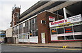
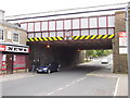
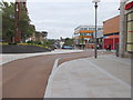
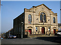
Photos of BB9 9RE
Area Information
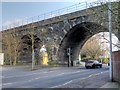
Living in BB9 9RE means inhabiting a small, densely populated residential cluster in England’s North West, nestled within the historic town of Nelson, Lancashire. With just 1,368 residents spread across 2,409 square metres, this area is characterised by its compact scale and high population density of 567,768 people per square kilometre. The community’s roots trace back to the 19th century, when the East Lancashire Railway and Leeds-Liverpool Canal spurred growth, shaping Nelson’s identity as a hub for cotton weaving. Today, BB9 9RE retains echoes of its industrial past, with historic streets like Manchester Road and Scotland Road still lined with 19th-century shops and weavers’ cottages. The area’s demographic profile reflects a mature population, with a median age of 47 and a strong presence of the Asian community. Daily life here balances proximity to rail networks and retail amenities with the quiet rhythm of a small town, where the local primary school and nearby railway stations anchor the community’s practical needs.
- Area Type
- Postcode
- Area Size
- 2409 m²
- Population
- 1368
- Population Density
- 567768 people/km²
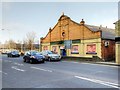
The property market in BB9 9RE is defined by its small size and the prevalence of houses over flats, with 34% of homes owned by residents. This suggests a mix of owner-occupied and rental properties, though the low home ownership rate may indicate a reliance on private rentals or shared ownership models. The area’s compact nature means housing stock is limited, with few new developments likely given its historical character. The predominance of houses, many of which date to the 19th century, implies a focus on traditional, possibly smaller properties. For buyers, this creates a niche market where availability is constrained, but properties may offer character features from Nelson’s industrial heritage. The immediate surroundings, including nearby towns like Colne and Burnley, could provide additional options for those seeking more space or modern housing. However, the area’s small footprint means competition for available properties is likely to be fierce, particularly for those prioritising proximity to rail links and local amenities.
House Prices in BB9 9RE
Showing 25 properties
| Address | Type | Beds | Baths | Last Sale Price | Last Sale Date | |
|---|---|---|---|---|---|---|
| 41 Pine Street, Nelson, BB9 9RE | house | - | - | £55,000 | Sep 2025 | |
| 31 Pine Street, Nelson, BB9 9RE | Terraced | 2 | 1 | £65,000 | Aug 2022 | |
| 38 Pine Street, Nelson, BB9 9RE | Retail | 2 | 1 | £62,000 | Apr 2022 | |
| 22 Pine Street, Nelson, BB9 9RE | house | - | - | £59,000 | Jan 2022 | |
| 46 Pine Street, Nelson, BB9 9RE | Terraced | 2 | 1 | £59,000 | Nov 2021 | |
| 24 Pine Street, Nelson, BB9 9RE | house | 2 | - | £26,000 | Jan 2021 | |
| 20 Pine Street, Nelson, BB9 9RE | Terraced | 2 | 1 | £56,000 | Oct 2019 | |
| 30 Pine Street, Nelson, BB9 9RE | house | 2 | 1 | £30,000 | Mar 2014 | |
| 27 Pine Street, Nelson, BB9 9RE | Terraced | - | - | £60,000 | Dec 2006 | |
| 42 Pine Street, Nelson, BB9 9RE | Terraced | - | - | £50,000 | Feb 2006 |
Energy Efficiency in BB9 9RE
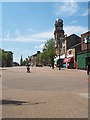
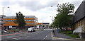
Life in BB9 9RE is shaped by its proximity to essential amenities, including five retail outlets such as Spar Netherfield, Lidl Central, and Farmfoods Marsden. These shops provide convenient access to groceries, everyday essentials, and local services, reducing the need for long trips to larger centres. The area’s rail network, with stations like Nelson and Colne, offers direct links to nearby towns and cities, enhancing mobility for work, shopping, or leisure. While the data does not specify parks or leisure facilities, the historical urban core of Nelson—centred on Manchester Road and Scotland Road—features 19th-century commercial premises and public spaces that contribute to a sense of community. The mix of retail and transport options, combined with the area’s compact size, creates a lifestyle that balances convenience with the character of a small town. Residents can enjoy a blend of practical amenities and the quiet charm of a historically significant neighbourhood.
Amenities
Schools
The nearest school to BB9 9RE is Walverden Primary School, a state-funded primary institution with a ‘good’ Ofsted rating. This school serves the local community, offering education for younger children in a setting that aligns with the area’s historical and cultural context. The absence of secondary schools in the immediate vicinity means families may need to consider commuting to nearby towns such as Nelson or Colne for secondary education. The presence of a primary school with a positive rating is a significant advantage, providing parents with a reliable option for early years education. However, the lack of higher-tier schools within BB9 9RE itself could be a limitation for families requiring a full range of educational facilities. The school’s performance reflects the area’s commitment to maintaining standards in education, though its isolation within the broader region necessitates planning for longer-term educational needs.
| Rank | School | Type | Entry gender | Ages |
|---|
Explore more schools in this area
Go to Schools tabDemographics
BB9 9RE’s population of 1,368 is predominantly composed of adults aged 30–64, reflecting a mature demographic with a median age of 47. Home ownership here is relatively low at 34%, suggesting a mix of owner-occupied and rented properties. The area’s accommodation is primarily houses, a contrast to the more common flats in larger urban centres. The predominant ethnic group is the Asian community, which shapes the cultural fabric of the neighbourhood. This demographic profile indicates a stable, established population, though the high population density of 567,768 people per square kilometre may influence living conditions. The lack of specific deprivation data means quality of life is inferred from the area’s infrastructure, such as its proximity to schools and transport links. The community’s age range and ownership rates suggest a balance between long-term residents and those seeking affordable housing, though the small size of BB9 9RE limits the diversity of household types.
Household Size
Accommodation Type
Tenure
Ethnic Group
Religion
Household Composition
Age
Household Deprivation
NS-SEC
Explore more demographic insights in this area
Go to Demographics tabPlanning
Planning Constraints
- Flood RiskPremium
- Ramsar Wetland SitesPremium
- Area of Outstanding Natural BeautyPremium
- Protected Nature ReservePremium
- Protected WoodlandPremium