Area Overview for BB9 8TE
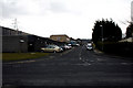
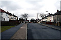
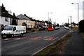
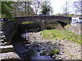
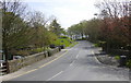
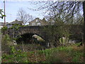
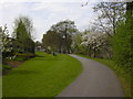
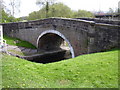
Photos of BB9 8TE
Area Information
Living in BB9 8TE means inhabiting a small, densely populated residential cluster in England’s North West, nestled within the town of Nelson. With just 1955 residents spread across 3 hectares, the area is compact yet vibrant, reflecting its historical roots as a 19th-century industrial hub. Nelson’s development was shaped by the Leeds-Liverpool Canal and the East Lancashire Railway, which brought economic growth and a wave of immigrants. Today, BB9 8TE sits at the heart of a community with a median age of 47, where adults aged 30–64 form the majority. Daily life here is defined by proximity to essential services, including five retail outlets like Asda Colne and Spar, and rail links to Colne, Nelson, and Brierfield stations. The area’s high population density—over 64,000 people per square kilometre—means it is both tightly knit and highly efficient, though its small size means every resident is within walking distance of local amenities. For those seeking a blend of history and modern convenience, BB9 8TE offers a snapshot of Nelson’s industrial past and its ongoing role as a commuter town.
- Area Type
- Postcode
- Area Size
- 3.0 hectares
- Population
- 1955
- Population Density
- 6772 people/km²
The property market in BB9 8TE is defined by its compact size and predominantly owner-occupied housing stock. With 50% of residents owning their homes, the area leans towards a mix of private ownership and rental activity, though the limited 3-hectare footprint means the housing stock is small. The accommodation type here is exclusively houses, which contrasts with areas where flats or apartments dominate. This suggests a preference for single-family homes, potentially appealing to families or those seeking more space. However, the area’s small size may limit availability, making it a competitive market for buyers. Proximity to rail links, including Colne and Nelson stations, adds to its appeal for commuters. For those considering BB9 8TE, the scarcity of properties means buyers must act decisively, while renters may find limited options. The lack of large-scale development projects implies a stable, unchanging market, with property values likely influenced by Nelson’s historical and industrial legacy.
House Prices in BB9 8TE
Showing 1 properties
| Address | Type | Beds | Baths | Last Sale Price | Last Sale Date | |
|---|---|---|---|---|---|---|
| Unit B, Regent Street, Nelson, BB9 8TE | Industrial | - | - | - | - |
Energy Efficiency in BB9 8TE
Life in BB9 8TE is shaped by its proximity to essential amenities, including five retail outlets such as Asda Colne, Asda Burnley, and Spar, which provide everyday shopping convenience. The area’s historical roots are evident in its commercial core, where 19th-century shops and market halls still operate. Rail links to Colne, Nelson, and Brierfield stations offer easy access to nearby towns, while the Burnley to Skipton road and routes to Halifax connect residents to broader regional networks. Though the area is small, its density ensures that most needs are met within walking distance. The presence of historic sites like Walverden Mill and the Nelson Town Hall adds cultural depth, while the town’s 19th-century chapels and weavers’ cottages reflect its industrial heritage. For residents, this means a lifestyle that balances practicality with a touch of historical character, supported by reliable transport and retail options.
Amenities
Schools
| Rank | School | Type | Entry gender | Ages |
|---|
Explore more schools in this area
Go to Schools tabDemographics
BB9 8TE’s population of 1955 is predominantly composed of adults aged 30–64, with a median age of 47. This suggests a mature, settled community, likely with established careers and families. Home ownership here is 50%, indicating a balanced mix of owner-occupied properties and rental units. The area is characterised by houses rather than flats or apartments, reflecting a traditional housing stock. The predominant ethnic group is the Asian community, which shapes the cultural fabric of the area. This demographic profile implies a community with strong family ties and a focus on stability. The high population density—over 64,000 people per square kilometre—means shared resources and services are in constant use. While this density can foster a sense of community, it also places pressure on local infrastructure. The presence of a significant Asian population may influence local businesses and cultural amenities, though specific data on deprivation or socioeconomic challenges is not provided.
Household Size
Accommodation Type
Tenure
Ethnic Group
Religion
Household Composition
Age
Household Deprivation
NS-SEC
Explore more demographic insights in this area
Go to Demographics tabPlanning
Planning Constraints
- Flood RiskPremium
- Ramsar Wetland SitesPremium
- Area of Outstanding Natural BeautyPremium
- Protected Nature ReservePremium
- Protected WoodlandPremium