Area Overview for BB9 8ND
Photos of BB9 8ND
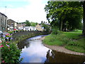
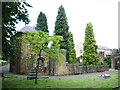
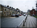
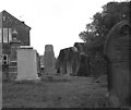
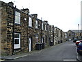
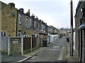
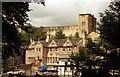
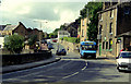
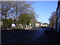
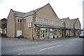
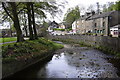
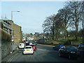
62 photos from this area
Area Information
Key information about the BB9 8ND including its size, population, and administrative classification.
- Area Type
- Postcode
- Area Size
- 6229 m²
- Population
- 1985
- Population Density
- 318649 people/km²
House Prices in BB9 8ND
20
Properties
£100,143
Average Sold Price
£40,750
Lowest Price
£201,000
Highest Price
Showing 20 properties
| Address | Type | Beds | Baths | Last Sale Price | Last Sale Date | |
|---|---|---|---|---|---|---|
| 49 Gisburn Road, Barrowford, BB9 8ND | Cottage | 2 | 1 | £56,750 | Jan 2025 | |
| 55 Gisburn Road, Barrowford, BB9 8ND | Terraced | 2 | 1 | £115,000 | Aug 2023 | |
| 27 Gisburn Road, Barrowford, BB9 8ND | Terraced | 3 | 1 | £125,000 | Dec 2022 | |
| 57 Gisburn Road, Barrowford, BB9 8ND | Terraced | 3 | 1 | £132,000 | Nov 2022 | |
| 35 Gisburn Road, Barrowford, BB9 8ND | house | - | - | £201,000 | Dec 2021 | |
| 31 Gisburn Road, Barrowford, BB9 8ND | Terraced | 3 | 1 | £113,500 | Nov 2019 | |
| 43 Gisburn Road, Barrowford, BB9 8ND | house | - | - | £110,000 | Oct 2019 | |
| 41 Gisburn Road, Barrowford, BB9 8ND | house | 2 | 1 | £75,000 | Jan 2019 | |
| 29 Gisburn Road, Barrowford, BB9 8ND | Terraced | 3 | 1 | £80,000 | Aug 2016 | |
| 45 Gisburn Road, Barrowford, BB9 8ND | Terraced | 3 | 2 | £88,000 | Dec 2007 |
Page 1 of 2
Energy Efficiency in BB9 8ND
Amenities
Schools
| Rank | School | Type | Entry gender | Ages |
|---|
Explore more schools in this area
Go to Schools tabDemographics
Household Size
One person
most common
Accommodation Type
Houses
most common
Tenure
56
majority
Ethnic Group
White
most common
Religion
N/A
most common
Household Composition
N/A
most common
Age
47
median
Adults (30-64 years)
most common
Household Deprivation
N/A
with no deprivation
NS-SEC
32
in Lower managerial occupations
Explore more demographic insights in this area
Go to Demographics tabPlanning
Planning Constraints
- Flood RiskPremium
- Ramsar Wetland SitesPremium
- Area of Outstanding Natural BeautyPremium
- Protected Nature ReservePremium
- Protected WoodlandPremium