Area Overview for BB9 7YT
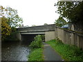
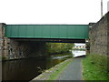
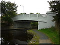
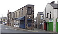
Photos of BB9 7YT
Area Information
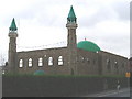
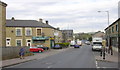
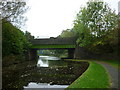
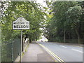
BB9 7YT is a small, densely populated residential postcode in England, covering just 6 hectares and home to 1,892 residents. Situated in the town of Nelson, part of the Borough of Pendle in Lancashire, this area reflects Nelson’s 19th-century origins as a hub for cotton weaving, shaped by the Leeds-Liverpool Canal and East Lancashire Railway. The town’s compact size and high population density of 31,314 people per square kilometre create a tightly knit community. Daily life here is influenced by Nelson’s historic character, with its 19th-century commercial streets and industrial heritage. While the area lacks expansive green spaces, its proximity to rail networks and retail hubs offers practical convenience. The demographic profile—skewed toward adults aged 30-64 and a strong Asian presence—suggests a mature, established population. For buyers, BB9 7YT offers a compact, high-density living environment with direct access to Nelson’s historical and modern amenities, though its small size means limited scope for expansion.
- Area Type
- Postcode
- Area Size
- 6.0 hectares
- Population
- 1892
- Population Density
- 2746 people/km²
BB9 7YT’s property market is defined by a 43% home ownership rate, with houses forming the primary accommodation type. This indicates a market skewed toward owner-occupation, though a significant portion of properties are likely rented, reflecting the area’s demographic profile of middle-aged residents. The small size of the postcode—just 6 hectares—means the housing stock is limited, with little scope for new developments. The predominance of houses over flats suggests a focus on family homes, though the high population density implies properties are likely smaller or multi-generational. For buyers, this area presents a challenge: the compact size and existing housing stock mean competition for properties, particularly for those seeking larger homes. The proximity to Nelson’s amenities, however, may offset the limitations of the local market, making it appealing to those prioritising convenience over space.
House Prices in BB9 7YT
No properties found in this postcode.
Energy Efficiency in BB9 7YT
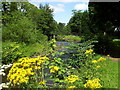
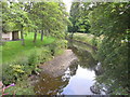
Life in BB9 7YT is shaped by its proximity to Nelson’s core amenities. Residents can access essential retail outlets like Morrisons Nelson and Booths Barrowford, ensuring daily shopping needs are met. The area’s rail network, with stations such as Nelson and Colne, provides easy access to broader regional hubs, reducing the need for long car journeys. While the data does not mention parks or leisure facilities, the town’s historic commercial streets and 19th-century architecture suggest a blend of practicality and character. The presence of multiple schools and community hubs likely fosters a localised social scene. For those prioritising convenience over expansive green spaces, BB9 7YT offers a compact, well-connected lifestyle with direct links to Nelson’s historical and modern amenities.
Amenities
Schools
Residents of BB9 7YT have access to a range of educational institutions, including Bradley Nursery School for early years education and two primary schools with good Ofsted ratings: Nelson St Philip’s Church of England Primary School and Holy Saviour Roman Catholic Primary School, Nelson. These schools provide a solid foundation for young children, with both state and faith-based options. The area also benefits from Nelson and Colne College, a sixth-form provider catering to older students. The presence of multiple primary schools within walking distance suggests a family-friendly environment, though the absence of secondary schools nearby may require commuting. For parents, the good Ofsted ratings indicate reliable education standards, but the lack of local secondary provision could be a consideration for long-term family planning.
| Rank | School | Type | Entry gender | Ages |
|---|
Explore more schools in this area
Go to Schools tabDemographics
The population of BB9 7YT is predominantly adults aged 30-64, with a median age of 47. This suggests a community of middle-aged residents, many of whom may be settled in long-term housing. Home ownership stands at 43%, indicating a mixed market where nearly half of properties are rented. The area is characterised by houses rather than flats, reflecting a traditional housing stock. The predominant ethnic group is Asian, which aligns with Nelson’s historical role as a destination for immigrant communities, particularly in the textile industry. This demographic profile shapes a community with established social networks and cultural practices. However, the high population density and limited green space may influence quality of life, particularly for families requiring larger living areas. The data does not indicate deprivation levels, but the mix of age groups and ownership suggests a balance between stability and potential challenges in housing affordability.
Household Size
Accommodation Type
Tenure
Ethnic Group
Religion
Household Composition
Age
Household Deprivation
NS-SEC
Explore more demographic insights in this area
Go to Demographics tabPlanning
Planning Constraints
- Flood RiskPremium
- Ramsar Wetland SitesPremium
- Area of Outstanding Natural BeautyPremium
- Protected Nature ReservePremium
- Protected WoodlandPremium