Area Overview for BB9 6PJ
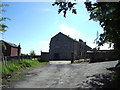
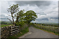
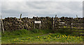
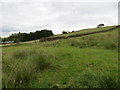
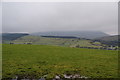
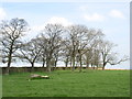
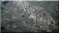
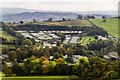
Photos of BB9 6PJ
Area Information
Living in BB9 6PJ means being part of a small, tightly knit residential cluster in Pendle Borough, Lancashire. With a population of 1,462 spread across a densely populated area of 937 people per square kilometre, this postcode reflects a community shaped by its historical roots as an agricultural and textile hub. Barrowford, the village it serves, sits at a river crossing over Pendle Water, with a legacy of handloom weaving and mills dating back to the 16th century. Today, the area balances its industrial past with modern living, offering proximity to rail links and retail amenities. Daily life here is defined by practicality, with residents relying on nearby shops, schools, and transport networks. The low crime risk and absence of environmental constraints make it a stable, if unassuming, place to live. For those seeking a quiet, family-oriented environment with access to regional infrastructure, BB9 6PJ provides a compact, functional base in the North West.
- Area Type
- Postcode
- Area Size
- Not available
- Population
- 1462
- Population Density
- 937 people/km²
The property market in BB9 6PJ is largely defined by owner-occupation, with 83% of homes owned outright. The accommodation type is predominantly houses, which is unusual for a small postcode area but aligns with Barrowford’s historical development as a village with traditional housing stock. This suggests a limited number of properties available, likely concentrated in older, established homes. The small size of the area means buyers must consider proximity to nearby towns for additional options. For those seeking a home here, the focus is on securing one of the existing houses, with little scope for new builds or rental properties. The high home ownership rate also implies a stable market, though the limited supply may make competition fierce for available properties.
House Prices in BB9 6PJ
No properties found in this postcode.
Energy Efficiency in BB9 6PJ
Life in BB9 6PJ is shaped by its proximity to practical amenities, including five retail outlets such as Spar, Morrisons Nelson, and Booths Barrowford. These shops provide essentials within easy reach, reducing the need for long trips. The area also offers recreational spaces like Barrowford Park, a Green Flag award-winning site with a lake formed from a former mill pond. This park serves as a focal point for leisure, walking, and community events. The village’s historical character, including 17th- to 18th-century farmhouses and conservation areas, adds a unique aesthetic to daily life. While the selection of dining and entertainment options is limited, the nearby rail stations connect residents to broader choices in surrounding towns. The blend of practical amenities and preserved heritage creates a functional, if modest, lifestyle.
Amenities
Schools
The schools nearest to BB9 6PJ include Marles Hill School and Marles Hill Centre (KS3) C O Personalised Curriculum Support and Service, both categorised as 'other' in type. While specific Ofsted ratings are not provided, the presence of two educational institutions suggests a range of options for families, though the types of schools listed do not indicate a mix of primary, secondary, or specialist provision. This could mean the area relies on nearby towns for more comprehensive schooling. Families should consider whether these schools meet their needs, particularly if they require a broader curriculum or specific educational support. The proximity of these institutions to BB9 6PJ makes them a practical choice for local residents.
| Rank | School | Type | Entry gender | Ages |
|---|
Explore more schools in this area
Go to Schools tabDemographics
The community in BB9 6PJ is predominantly composed of adults aged 30–64, with a median age of 47. This suggests a mature, established population, likely with long-term ties to the area. Home ownership is high at 83%, indicating a strong presence of owner-occupied properties. The accommodation type is primarily houses, which aligns with the area’s residential character. The predominant ethnic group is White, reflecting broader demographic patterns in the region. With no data on deprivation levels, the focus remains on the tangible aspects of life here: a stable, low-risk environment where most residents are settled in their homes. The age profile suggests a community focused on maintaining existing lifestyles, with fewer young families or transient populations compared to other areas.
Household Size
Accommodation Type
Tenure
Ethnic Group
Religion
Household Composition
Age
Household Deprivation
NS-SEC
Explore more demographic insights in this area
Go to Demographics tabPlanning
Planning Constraints
- Flood RiskPremium
- Ramsar Wetland SitesPremium
- Area of Outstanding Natural BeautyPremium
- Protected Nature ReservePremium
- Protected WoodlandPremium