Area Overview for BB9 0WD
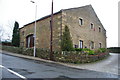
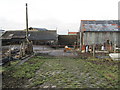
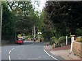
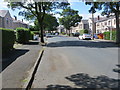
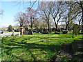
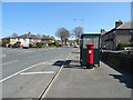
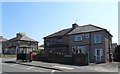
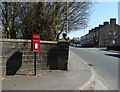
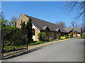
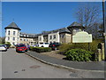
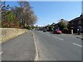
Photos of BB9 0WD

Area Information
The BB9 0WD postcode covers a small residential cluster of just one hectare, hosting a community of 2,365 residents. Living in this specific pocket of Great Marsden, you will find a settlement that has evolved from historic agricultural hamlets into a modern satellite of the larger town of Nelson. The town itself originated in the mid-19th century, developing rapidly around the Leeds-Liverpool Canal and the East Lancashire Railway before gaining municipal borough status in 1890. Today, this area sits four miles north of Burnley within the Borough of Pendle, benefiting from a history driven by cotton weaving and a strong trade union tradition. Daily life here is shaped by its compact size and integration into the wider Nelson urban core. The immediate surroundings feature the town's historic commercial heart, centred on Manchester Road, Scotland Road, and Market Street. While the specific BB9 0WD area is a quiet residential enclave, its proximity to the canals and railways means you are close to the markets and industrial heritage of a Victorian new town. The high population density of 802 people per square kilometre suggests a lively neighbourhood atmosphere without the sprawl of larger suburban developments. You are living in a place where the past industrial heritage remains visible, yet the focus is firmly on contemporary family living within a tight, supportive community.
- Area Type
- Postcode
- Area Size
- 1.0 hectares
- Population
- 2365
- Population Density
- 802 people/km²
Homes in BB9 0WD overwhelmingly lean towards owner-occupation, a fact underscored by the 68% home ownership rate recorded for this postcode. This statistic paints a clear picture of the property market: it is not a typical high-let rental hub but rather a community where residents have invested in their own bricks and mortar. The predominant accommodation type is houses, which fits the profile of a settled area likely containing detached or semi-detached properties suitable for the adult-dominated population. Buying a home here offers the security of tenure in a compact environment. The tight residential cluster of just one hectare means that properties are likely to be well-maintained by their owners, fostering a sense of pride in individual addresses. This contrasts with areas dominated by private renting, where turnover can be high and maintenance is sometimes delayed. The high proportion of owner-occupiers implies a stable market where buyers are purchasing a fixed asset rather than looking for flexibility. If you are considering homes in BB9 0WD, you are entering a market defined by stability and long-term residency, where the local population values the permanence of ownership.
House Prices in BB9 0WD
Showing 14 properties
| Address | Type | Beds | Baths | Last Sale Price | Last Sale Date | |
|---|---|---|---|---|---|---|
| 9 Hartley Drive, Nelson, BB9 0WD | Detached | 3 | 3 | £200,000 | Mar 2023 | |
| 10 Hartley Drive, Nelson, BB9 0WD | house | - | - | £220,000 | Nov 2020 | |
| 5 Hartley Drive, Nelson, BB9 0WD | Detached | 4 | 1 | £199,500 | Jan 2020 | |
| 19 Hartley Drive, Nelson, BB9 0WD | house | - | - | £199,950 | May 2019 | |
| 1 Hartley Drive, Nelson, BB9 0WD | Detached | 3 | 2 | £145,000 | Nov 2017 | |
| 2 Hartley Drive, Nelson, BB9 0WD | house | - | - | £180,000 | Mar 2015 | |
| 4 Hartley Drive, Nelson, BB9 0WD | house | - | - | £155,000 | Mar 2014 | |
| 8 Hartley Drive, Nelson, BB9 0WD | house | 4 | - | £172,500 | Jun 2013 | |
| 7 Hartley Drive, Nelson, BB9 0WD | house | - | - | £184,500 | Mar 2006 | |
| 17 Hartley Drive, Nelson, BB9 0WD | house | - | - | £176,000 | Jan 2006 |
Energy Efficiency in BB9 0WD
Living in BB9 0WD offers immediate access to essential retail and leisure options in the nearby towns. You can shop, dine, and errand-run in a matter of minutes without needing a car for most daily tasks. Five retail outlets operate within practical reach, including the Spar Netherfield, Farmfoods Marsden, and another Spar location. These supermarkets are integrated into the local fabric, providing for all your weekly food and household needs directly from the doorstep. Beyond retail, the area is supported by five railway stations that function as key transport nodes for leisure and business. While less traditional recreation is listed in the immediate immediate amenities, the proximity to Nelson ensures access to its historic town centre, the canal network, and the public housing stock of the wider borough. The community character is bolstered by these accessible services, which reduce the frustration of long commutes for routine activities. When considering the daily convenience of homes in this postcode, the density of nearby shops and transport hubs means you spend less time planning journeys and more time enjoying the neighbourhood.
Amenities
Schools
Families buying in BB9 0WD benefit from immediate access to two primary schools, both located within the wider Great Marsden area. These institutions are Great Marsden St John's Church of England Primary School and Great Marsden St John's Primary School A Church of England Academy. The latter carries an Ofsted rating of good, a metric that signals consistent educational standards and operational effectiveness. Both are primary schools, catering to children in the early stages of their education. This mix of schools provides straightforward choices for local families. The presence of two nearby options reduces the need for long-term travel to find education for young children, supporting a lifestyle where school run times are manageable. The fact that both are Church of England academies suggests a shared curriculum and ethos focused on community values. For parents specifically looking at schools near BB9 0WD, the data indicates that quality primary education is not a concern. The "good" rating on the Academy section offers a concrete reassurance of performance, meeting the expectations of families prioritising educational proximity and verified standards when they choose this postcode.
| Rank | School | Type | Entry gender | Ages |
|---|
Explore more schools in this area
Go to Schools tabDemographics
The population profile in BB9 0WD reflects a mature, established community. The median age stands at 47 years, with adults aged between 30 and 64 forming the most common age range. This demographic structure indicates a neighbourhood where families with older children or empty nesters are prevalent, rather than a youth-heavy area. House ownership is strong, with 68% of residents owning their homes outright or via mortgage. This high rate of tenure suggests stability, as owner-occupiers are often more deeply rooted in their local community than private renters. Accommodation in this cluster primarily takes the form of houses, aligning with the preference for traditional family living. The predominant ethnic group is White, though the specific locality benefits from integration with the broader diversity found in surrounding Great Marsden and Nelson. The specific population of 2,365 residents within this one-hectare boundary creates a density of 802 people per square kilometre. This figure is significantly higher than the national average, contributing to a sense of closeness among neighbours. The lack of young children in the median data further supports the observation that this is a settled, established area where long-term families have built their lives.
Household Size
Accommodation Type
Tenure
Ethnic Group
Religion
Household Composition
Age
Household Deprivation
NS-SEC
Explore more demographic insights in this area
Go to Demographics tabPlanning
Planning Constraints
- Flood RiskPremium
- Ramsar Wetland SitesPremium
- Area of Outstanding Natural BeautyPremium
- Protected Nature ReservePremium
- Protected WoodlandPremium