Area Overview for BB9 0RZ
Photos of BB9 0RZ
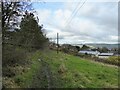
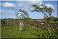
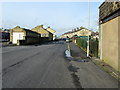
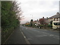
15 photos from this area
Area Information
Key information about the BB9 0RZ including its size, population, and administrative classification.
- Area Type
- Postcode
- Area Size
- 1.0 hectares
- Population
- 1722
- Population Density
- 2144 people/km²
House Prices in BB9 0RZ
41
Properties
£90,213
Average Sold Price
£45,000
Lowest Price
£148,000
Highest Price
Showing 41 properties
| Address | Type | Beds | Baths | Last Sale Price | Last Sale Date | |
|---|---|---|---|---|---|---|
| 131 Waidshouse Road, Nelson, BB9 0RZ | Terraced | 3 | 1 | £97,000 | Jul 2024 | |
| 121 Waidshouse Road, Nelson, BB9 0RZ | Terraced | 3 | 1 | £120,000 | Aug 2023 | |
| 105 Waidshouse Road, Nelson, BB9 0RZ | Semi-detached | 3 | 1 | £113,500 | Apr 2023 | |
| 107 Waidshouse Road, Nelson, BB9 0RZ | Semi-detached | 2 | 1 | £97,000 | May 2022 | |
| 92 Waidshouse Road, Nelson, BB9 0RZ | house | - | - | £147,500 | Jan 2022 | |
| 145 Waidshouse Road, Nelson, BB9 0RZ | house | - | - | £99,950 | Jul 2021 | |
| 129 Waidshouse Road, Nelson, BB9 0RZ | Terraced | 3 | 1 | £72,000 | Oct 2020 | |
| 141 Waidshouse Road, Nelson, BB9 0RZ | house | - | - | £86,000 | Jan 2020 | |
| 96 Waidshouse Road, Nelson, BB9 0RZ | Semi-detached | 3 | 1 | £114,000 | May 2018 | |
| 127 Waidshouse Road, Nelson, BB9 0RZ | house | 3 | - | £76,000 | Aug 2016 |
Page 1 of 5
Energy Efficiency in BB9 0RZ
Amenities
Schools
| Rank | School | Type | Entry gender | Ages |
|---|
Explore more schools in this area
Go to Schools tabDemographics
Household Size
Two person
most common
Accommodation Type
Houses
most common
Tenure
80
majority
Ethnic Group
White
most common
Religion
N/A
most common
Household Composition
N/A
most common
Age
47
median
Adults (30-64 years)
most common
Household Deprivation
N/A
with no deprivation
NS-SEC
26
in Lower managerial occupations
Explore more demographic insights in this area
Go to Demographics tabPlanning
Planning Constraints
- Flood RiskPremium
- Ramsar Wetland SitesPremium
- Area of Outstanding Natural BeautyPremium
- Protected Nature ReservePremium
- Protected WoodlandPremium